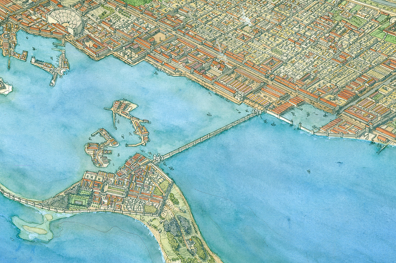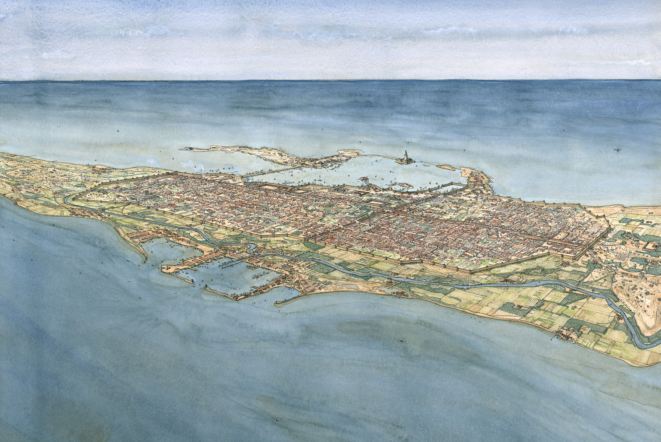
View of Alexandria in the Roman era from Lake Mariout © J.-Cl. Golvin, 1998
The lakeside port
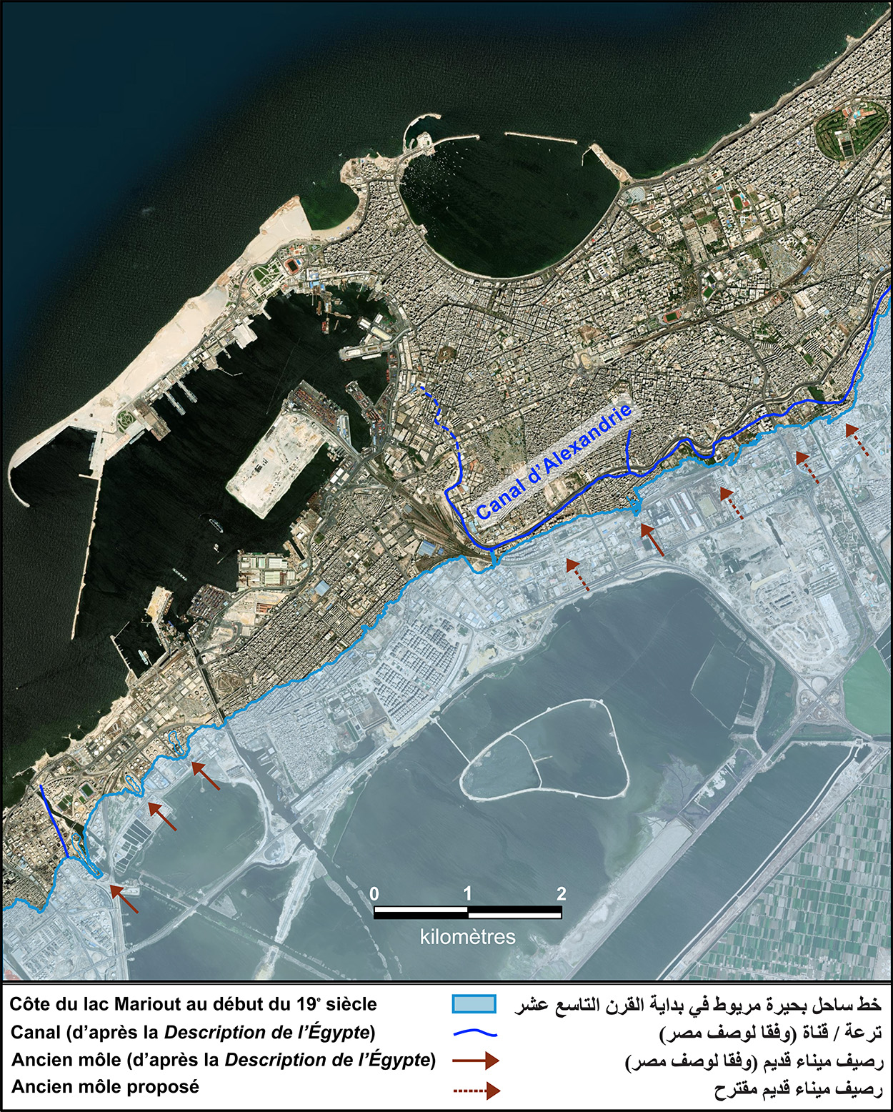
The ancient lake port is now buried beneath the city. Nevertheless, the study of ancient cartography and geomorphological research has enabled us to reconstruct a series of moles that shaped the harbour and mooring areas to the south and west of the city. Geological coring near one of the jetties shown on the map of the Description de l’Égypte revealed a sudden change in the nature of the geological strata from the Early Roman period onwards, a sign of the intensification of port activity. At that time, wheat transported to Rome from all over Egypt accounted for a third of the wheat needed to feed the imperial capital. The market for luxury goods, such as spices and precious stones from the Arabian Peninsula and India, expanded greatly. It was also at this time that the customs station of Schedia (Kafr el-Dawar) to the east of Alexandria was redeveloped and the port of Taposiris Magna to the west grew.
Strabo talks of the lake port at the end of the 1st century BC.
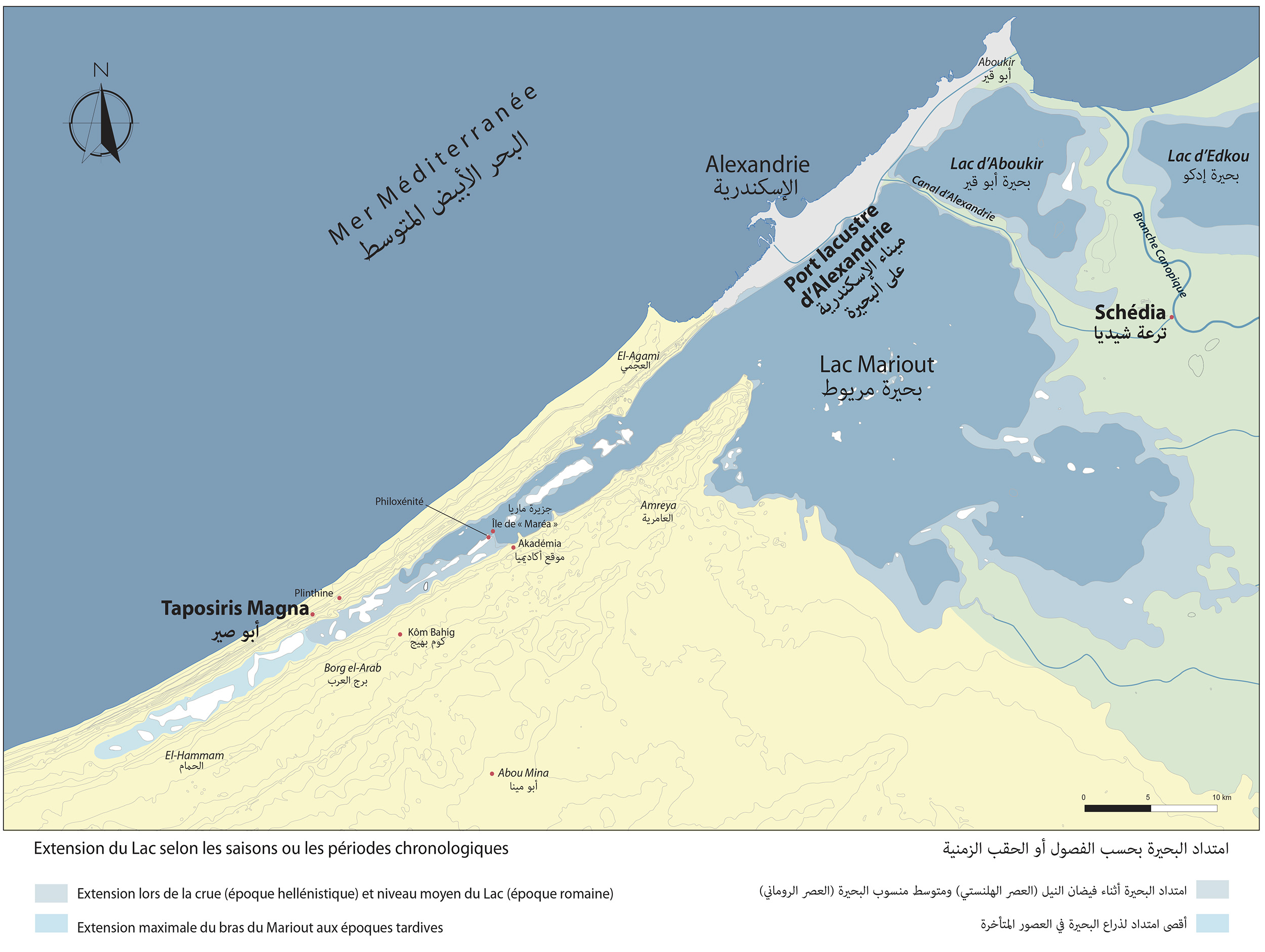
Lake Mariout and the region surrounding Alexandria in ancient times. V. Pichot © Archives CEAlex
The Kibotos
At the landward edge of the bay of the Port of Safe Return, which was reportedly used mainly as an anchorage for warships, an enclosed artificial harbour was built – “dug by man” according to Strabo. This Kibotos (Box) was located close the beginning of the Heptastadion. It was bordered by an arsenal and a shipyard, and was linked to the port of Lake Mareotis by a canal that provided an easy connection between the Mediterranean and the hinterland.
On the lake side, trade flowed through a network of canals from the Nile that fed the lake area, as well as through the Alexandria canal dug by Ptolemy I’s brother.
The Alexandria canal, as well as the Kibotos and its canal, are objects of study at the crossroads of historical, archaeological and geoarchaeological approaches. They highlight the complex relationship between the Mediterranean and Lake Mareotis, whose level was below that of the sea.
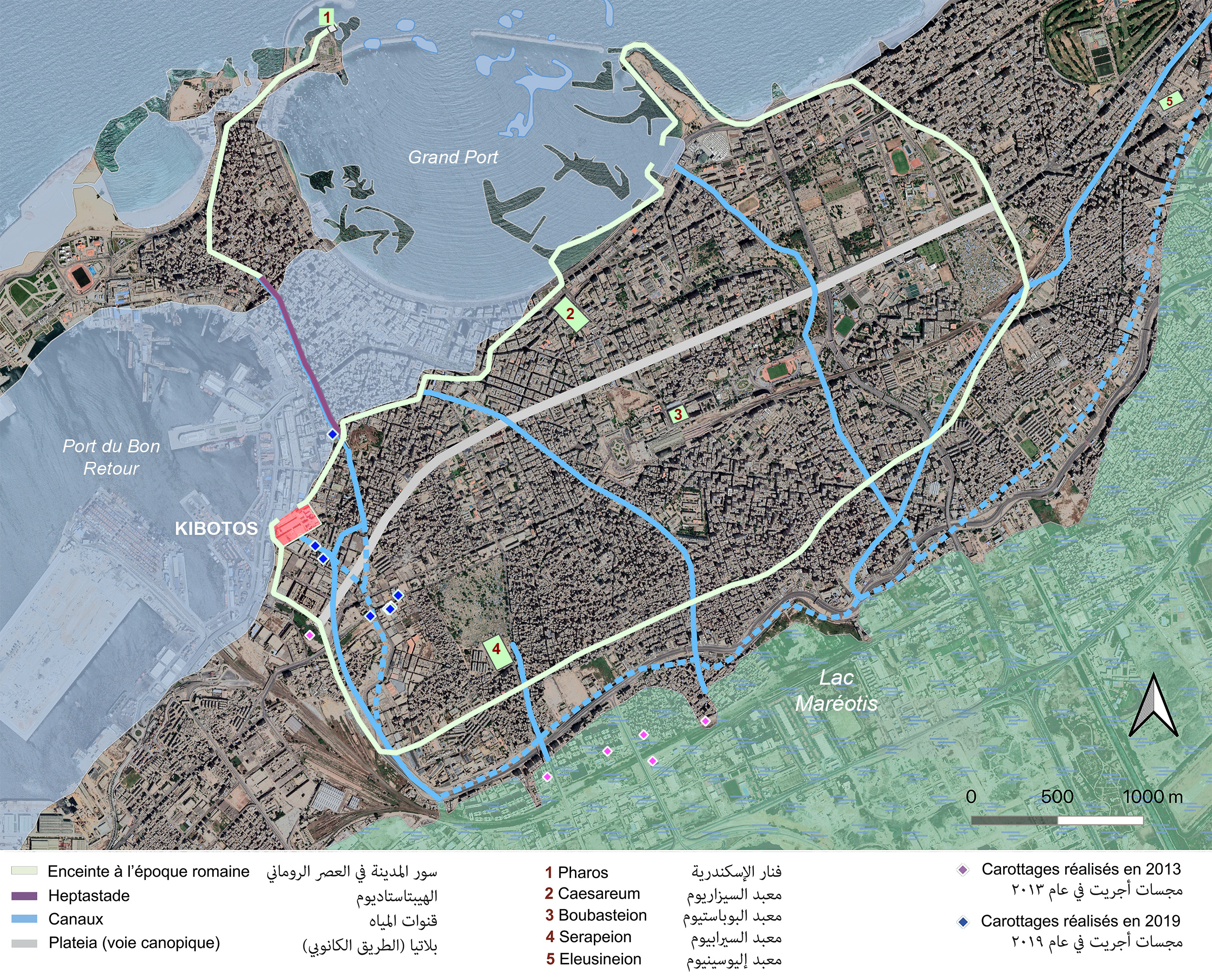
Alexandria in the Roman era: defensive wall, road network, main temples, canals and the presumed site of the Kibotos. I. Hairy © Archives CEAlex
Strabo describes the maritime harbours at the end of the 1st century BC.
The Heptastadion
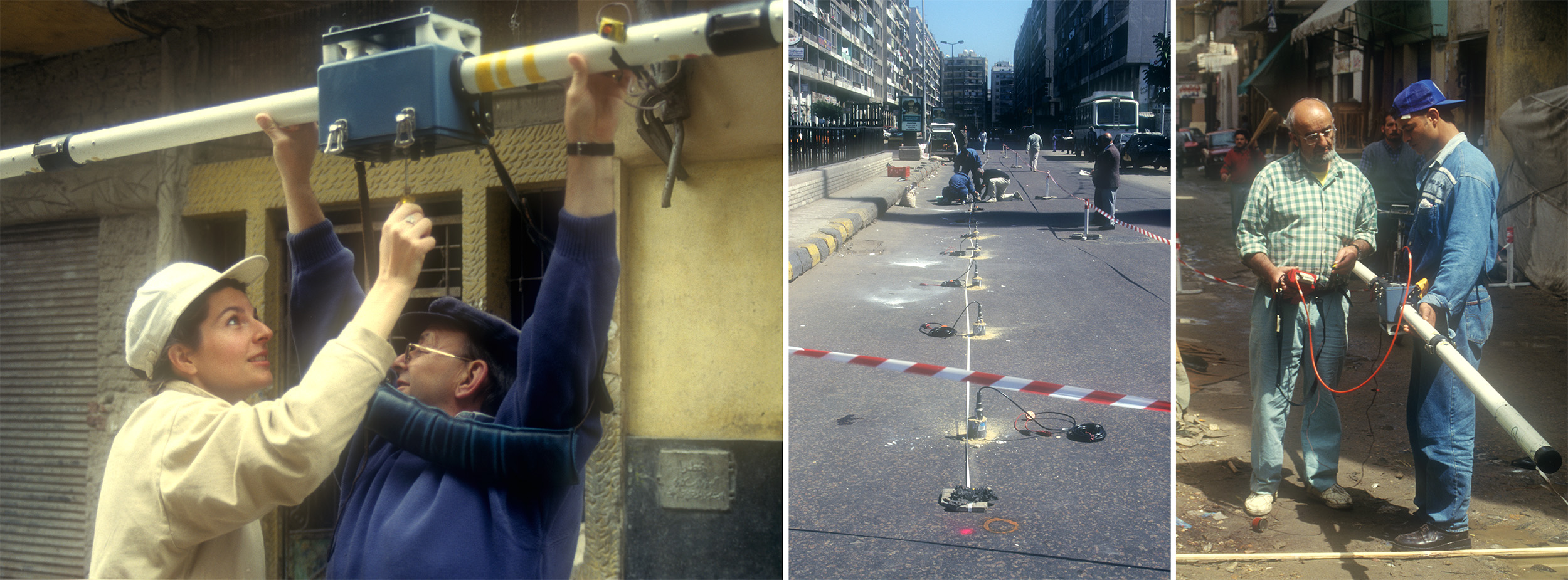
Geophysical prospection in a street on the spit of land between the island of Pharos and the mainland. A. Hesse © CEAlex Archives
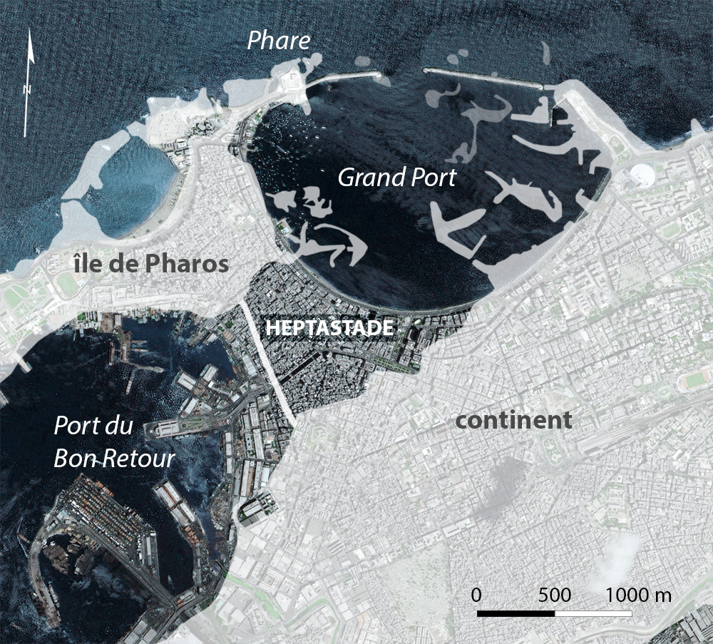
The Heptastade was an exceptional feat of engineering for its time: a 1,300-metre causeway and dike combined with an aqueduct to supply water to the island of Pharos, and two bridges to allow boats to travel between the two ports. Alexander had this seven-stadia causeway built between the mainland and the island, thus creating two ports: to the east, the Great Port, ὁ μέγας λιμήν, and to the west, the Port of Safe Return, ὁ λιμήν τοῦ Εὐνόστου. He drew on the experience he had gained, particularly during the siege of Tyre in 332, in a similar natural configuration: an island connected to the mainland by a causeway.
Though invisible today, the line of the Heptastadion was revealed thanks to geophysical surveys and geomorphological studies carried out by the CEAlex. Its construction was Alexander’s first urban project and it became the backbone of the city. This route and the future Plateia, or Canopic Way, set perpendicular at 90°, defined the orientation of the ancient city’s road network, which persists to this day.
The Pharos
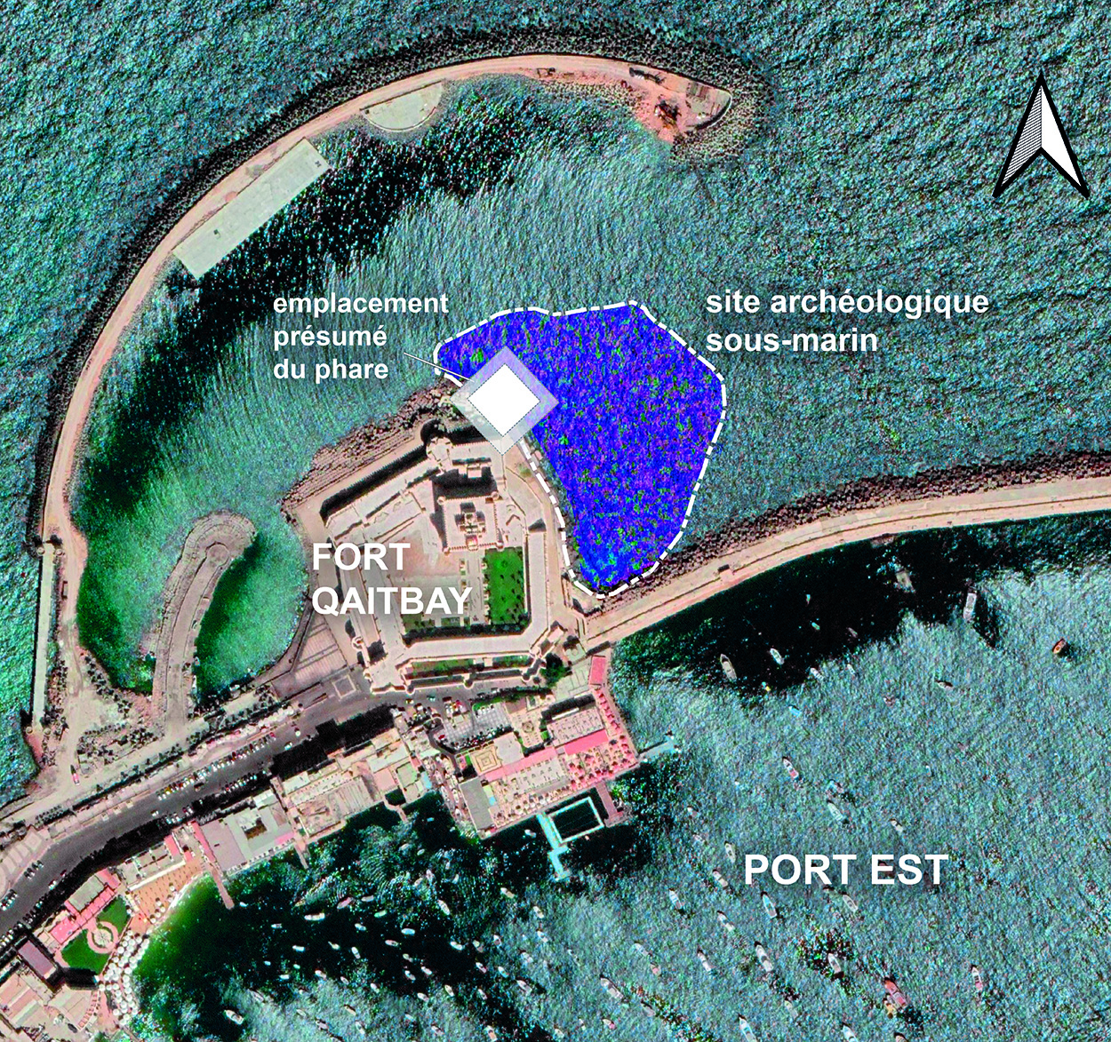
Built by Ptolemy I and inaugurated by his son Ptolemy II Philadelphus, the Pharos of Alexandria stood for nearly 17 centuries before disappearing in the mid-14th century after a series of earthquakes. Today, the site is completely submerged due to the subsidence that has affected the Alexandrian coastline, plunging parts of the ancient city to more than 6 m below current sea level. Having documented the underwater site since 1994, the CEAlex is now building a precise 3D model, using photogrammetry, which offers new possibilities for studies and presentations to the public.
To date 4081 architectural and sculptural blocks have been recorded and documented from an area of over 1.6 hectares. A monumental Doric style doorway that once belonged to the Pharos has been graphically reconstructed from fragments found in the north-western part of the site. The gateway measures 11.5 m x 4.9 m and is 2.1 m deep. Traces of damage and fractures at weak points indicate that the structure was violently destroyed. The statues that once decorated the entrance to the building, shattered into multiple pieces, have also been reconstructed using 3D technology.
The Arab geographer Idrisi describes the lighthouse in the 12th century
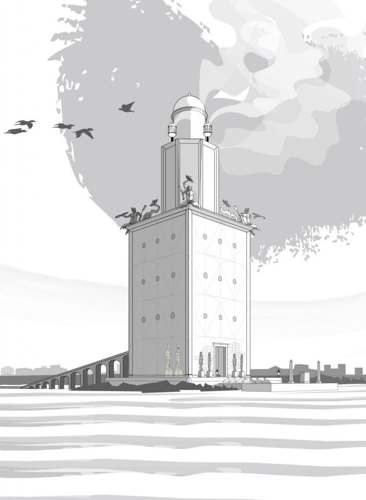
Reconstructed view of Alexandria’s lighthouse. I. Hairy © Archives CEAlex

