Tabiyet Nahassin
Team leader : Kathrin Machinek
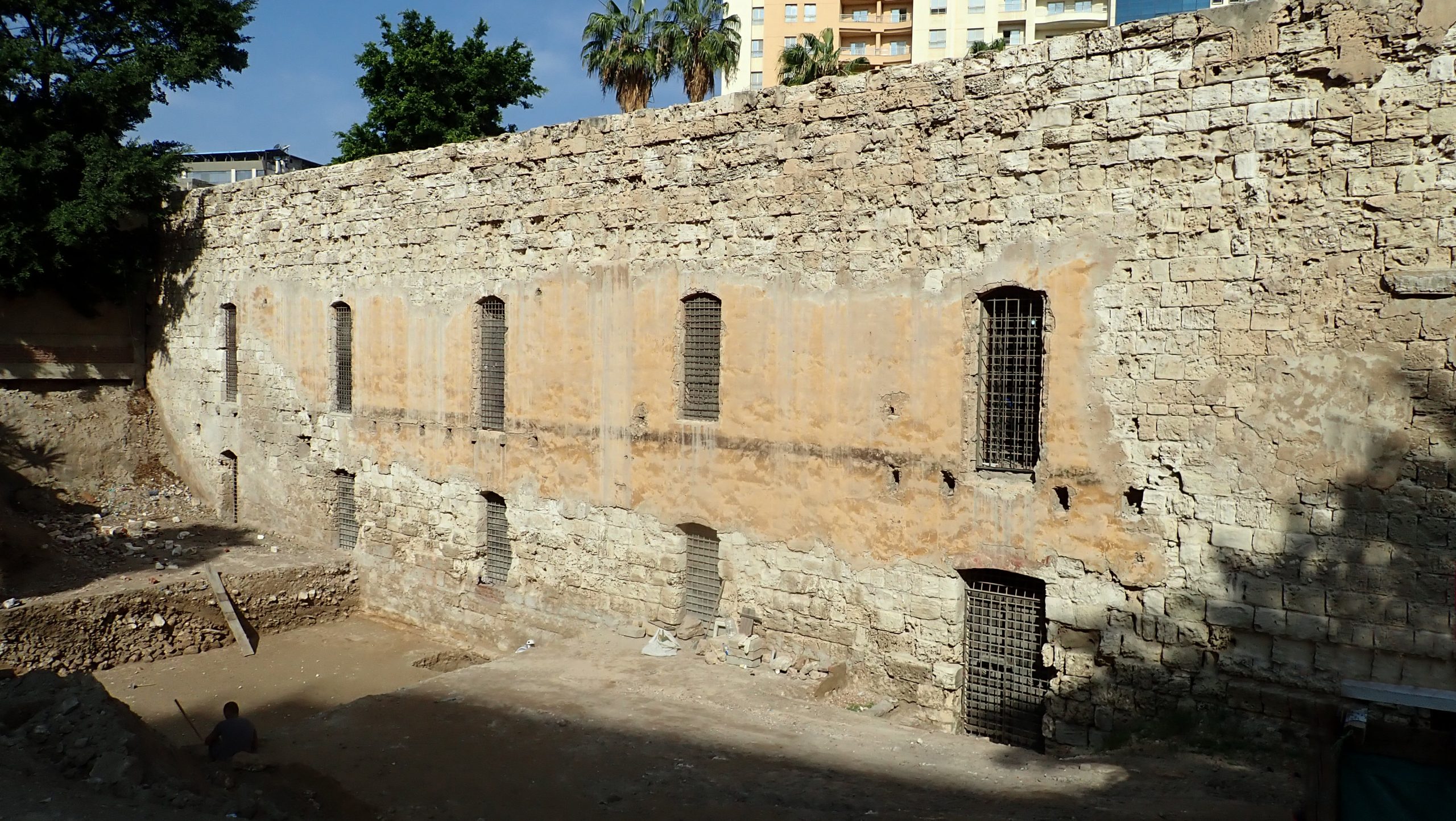
The Tabiyet Nahassin site is located in the centre of Alexandria. It is bounded to the north by the façade of Fort Nahassin, which the Ministry of Antiquities has generously made available to the CEAlex as an archaeological storehouse. The site is bordered to the south by Sultan Hussein Street, to the west by the Youth Club building and to the east by Shallalat Gardens. The plot measures approximately 40 m by 17 m, with a 3.50 m difference in level between the street and the bottom of the moat in front of the fort.
Until 2015, the site was occupied by a health clinic, built around 1970. After it was demolished, the Department of Islamic Antiquities, which owns the plot, asked the CEAlex to build a surrounding wall to comply with Egyptian law concerning archaeological sites in urban settings.
Fort Nahassin is the only vestige of a bastion erected in 1845 up against the medieval double wall: it was used as a cartridge factory (nahassin). The entire fortified belt, built under the orders of Colonel Gallice Bey, was demolished towards the end of the 19th century, but it appears on many old maps. Analysis of these maps suggests that the southern front of the bastion, marked by the cartridge factory, was placed along the line of the outer wall, after a section of the latter had been levelled. This hypothesis is supported by the medieval remains that remain in the vicinity: a corner tower (extra-muros) to the east and the El-Nabih cistern (intra-muros) to the west provide reference points for tracing the line. In addition, the basement of the cartridge factory has a series of windows and a doorway leading to the moat in front of the southern façade. This depression marks the difference in level between the town and the land outside the town walls, and may correspond to the space between the old main wall and the front wall of the medieval double wall.
This historical and topographical context suggested the possibility that the line of the medieval wall ran along the perimeter of the plot, and led us to complement the preparatory work for the construction of the new wall with an archaeological survey, which took place from 16 June to 19 December 2019.
Along with the usual manual clearing work, a mini-loader and dump trucks were used for the removal of the flooring and reinforced concrete foundations of the clinic. Beneath the basement of the clinic, the remains of planting connected with the creation of Shallalat Gardens at the beginning of the 20th century were uncovered over the entire surface area of the site. In the western part, a test trench revealed remarkable stratigraphic continuity, enabling the study of remains dating from the 19th century to the Roman period.
A long period of ancient occupation was revealed, with remains dating back to the Imperial era. The area appears to have been used as a residential space, as evidenced by the discovery of much painted plaster, some mosaic tesserae and a wealth of tableware (ceramic and glass crockery). The remains of a kitchen, with two circular ovens set side-by-side, are further evidence of the function of this plot.
Following a phase of abandonment of this sector of the ancient city, characterised by the presence of black earth linked to plantation pits, the walls of the ancient residential district were the main target of trenches up to 2 m deep, aimed at recovering the relatively accessible building materials, probably as part of the construction and redevelopment of the fortified wall. The levels associated with the construction and occupation of Fort Nahassin were documented, providing valuable evidence of daily life during the period from the monument’s foundation in the mid-19th century through to its use as an archaeological storehouse today. On the other hand, the remains of the main wall of the medieval fortifications must be located outside the area under study, with embankments of debris and limestone rubble indicating its presence further to the south-west, beneath the car park on Sultan Hussein Street.
-
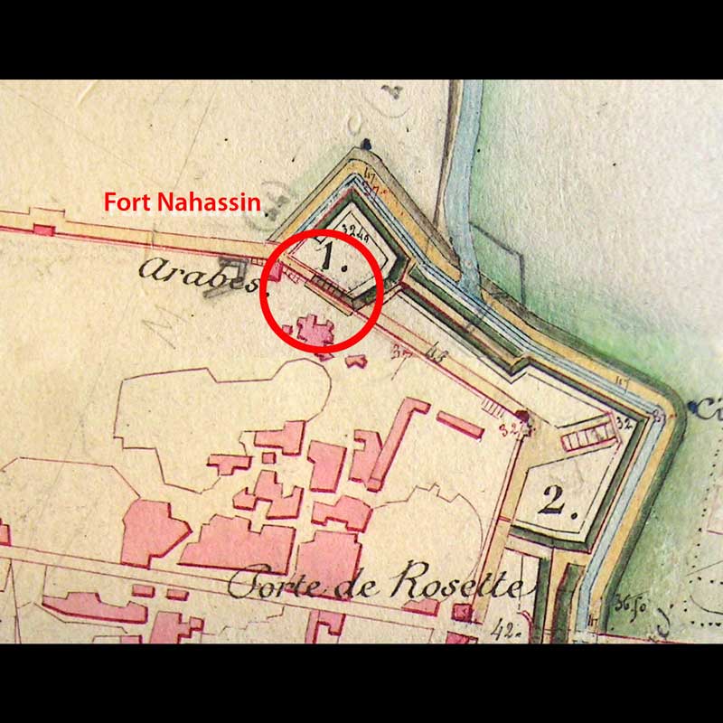
Extract from the map by Gallice Bey showing the site in 1845 -
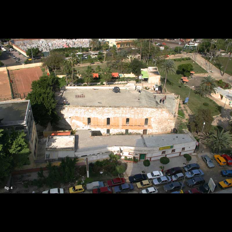
The site in 2005 with health clinic -
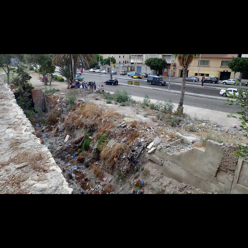
The site before intervention in June 2019, seen from the roof of the fort -
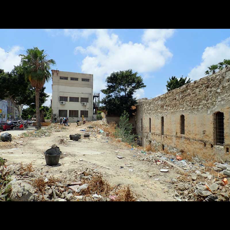
The site at the beginning of the operation, looking westwards -
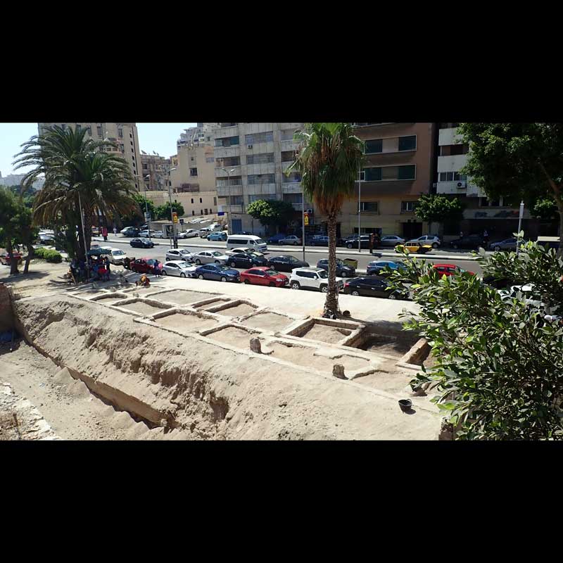
Reinforced concrete foundations of the clinic -
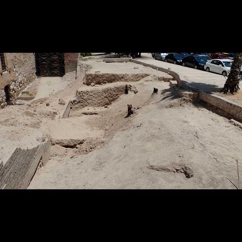
Vestiges from Shallalat Gardens, 2nd half of the 20th century -
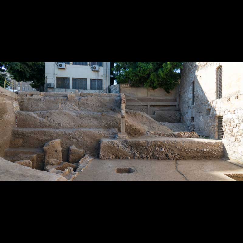
The site at the end of operations, December 2019, looking westwards -

Ottoman terracotta tobacco pipe
