The Diana Theatre
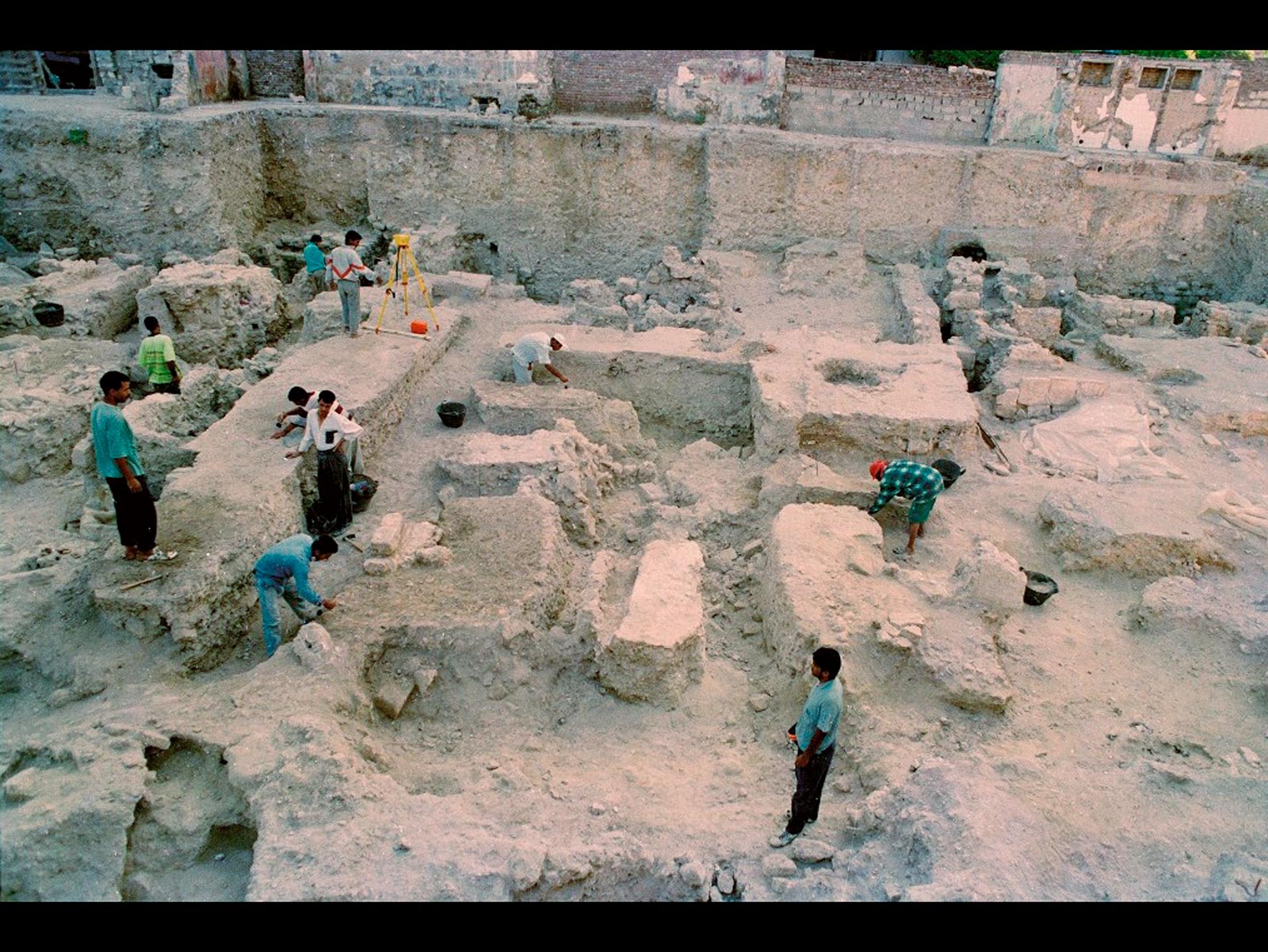
Located in the centre of the modern city, the site of the Diana Theatre was, in Ptolemaic times, part of the Brucheion district, a wealthy residential area close to the royal palaces. According to the map drawn up by Mahmoud Bey el-Falaki in 1866, the site was located at the south-east corner of an urban block bordered by road R4, one of the main streets of ancient Alexandria.
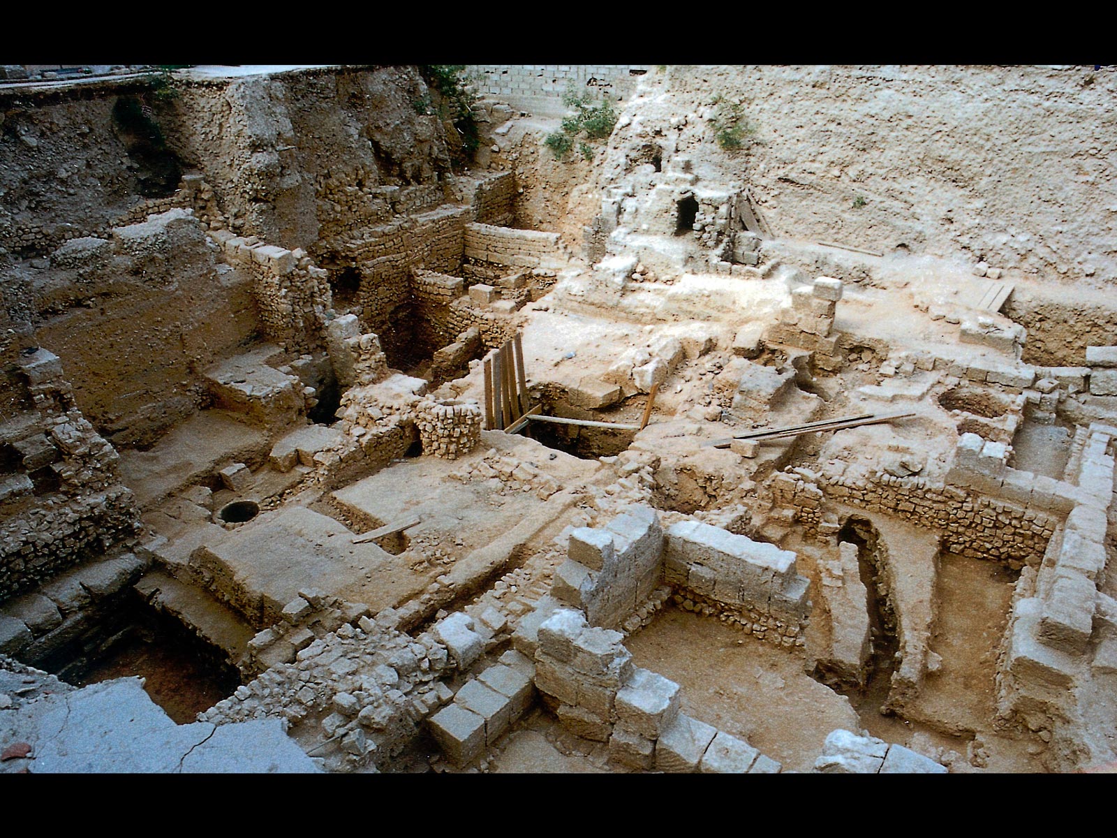
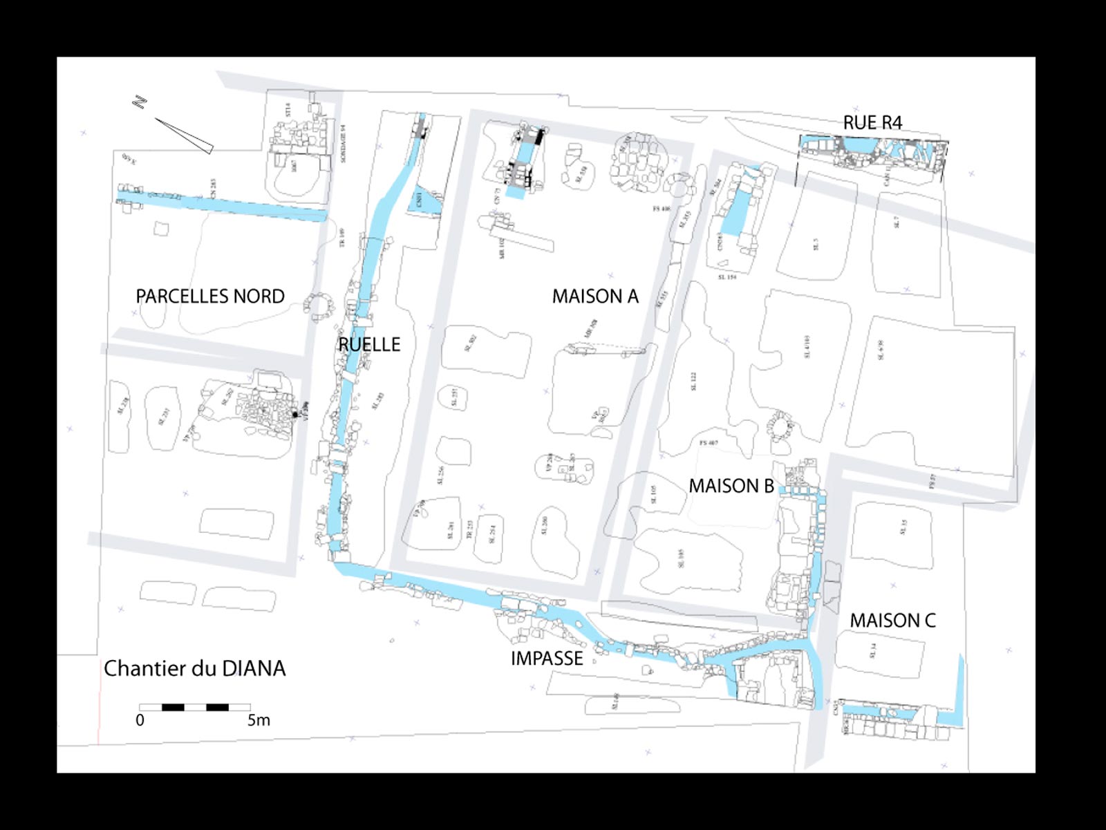
From 1994 to 1997, the 450 m2 site was the subject of an archaeological operation that took place in three missions over a total period of 18 months. The levels excavated attest to continuous occupation from the 3rd BC to the 7th century AD. This was an urban environment characterised by the continuity of the plot division, with boundary walls built on top of previous ones. Four plots have been identified, on either side of an east/west thoroughfare.
Six major chronological phases have been identified. A monumental wall and a street running north-east/south-west, dated to the 3rd century BC, are the oldest structures uncovered on the site. Then, in the 2nd century BC, housing appeared, following a new north/south orientation.
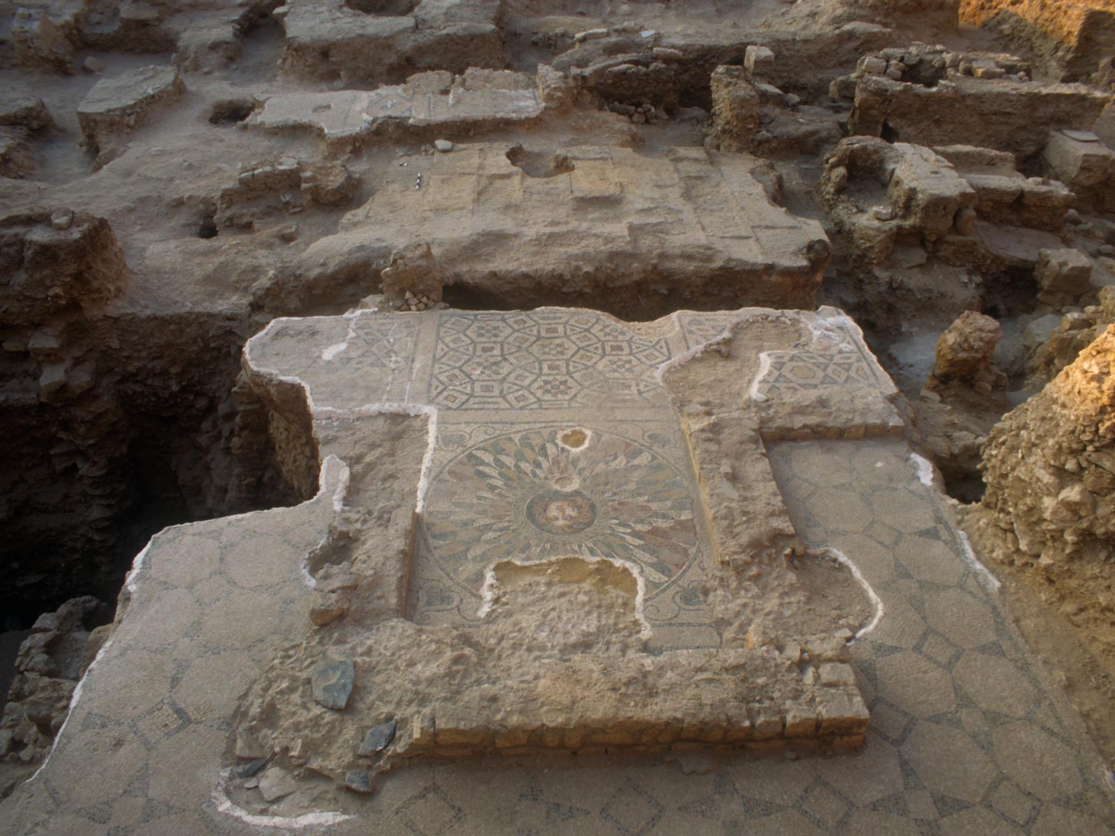
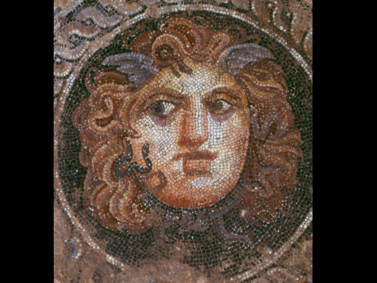
During the 1st century AD, an initial Roman residential level is characterised by well-defined plot boundaries, but the occupation levels were disturbed. This was followed by several dwellings decorated with mosaics. The eight mosaics belong to three houses, dating from the 2nd and 3rd centuries. The best preserved of these has an L-shaped floor plan covering an area of around 150 m2. Although fragmentary, this plan reveals a luxurious and spacious house, with an upper floor. Along with its neighbours, also decorated with mosaics, it was part of a residential area. The stylistic homogeneity of the pavements seems to indicate the activity of a single mosaic workshop. The renovation work was carried out at the same time as the building, and may have been part of a fashion based on the mosaicist’s reputation.
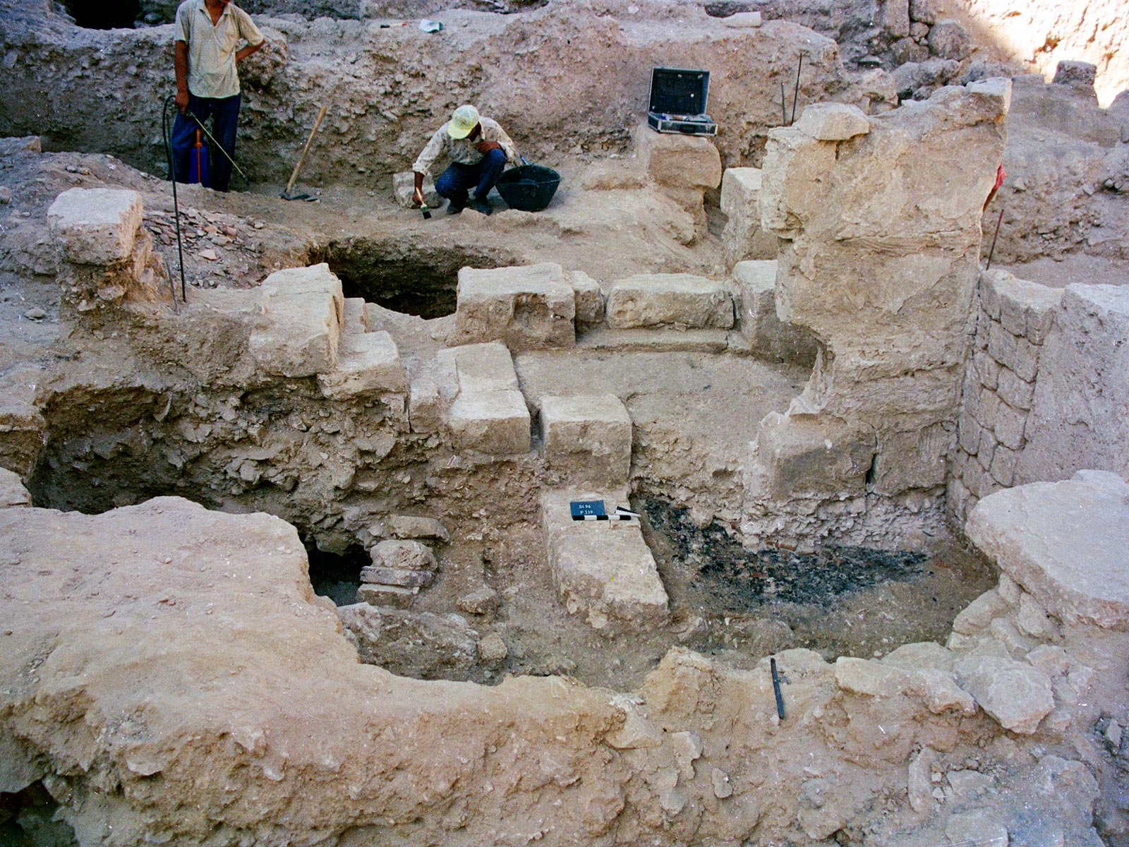
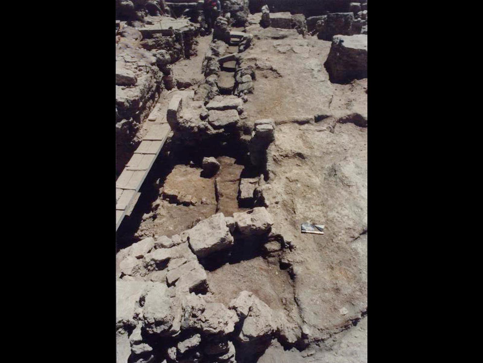
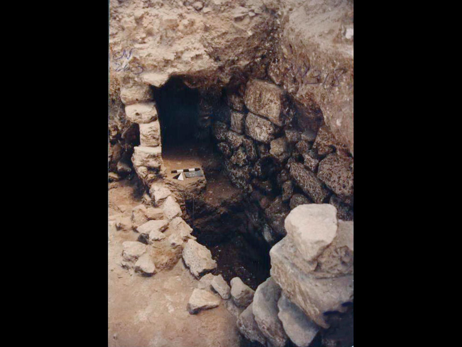
These houses were replaced at the end of the 3rd century AD by another residential neighbourhood with their own water supply network, which lasted until the end of the 5th century. The water system revealed here was well thought-out and well managed, evidence of careful urban administration, probably in keeping with the social status of the inhabitants. This was a well-equipped and well-maintained affluent area during the Hellenistic and Imperial Periods. By the end of the 5th century, however, the situation had changed. The area was then occupied by craftsmen whose stalls gradually extended beyond the perimeter of the east/west street, which probably became a small, congested shopping street. The drains in the block were abandoned, the structures salvaged and they disappeared from the urban landscape, illustrating the deterioration of the sanitary conditions of the inhabitants.
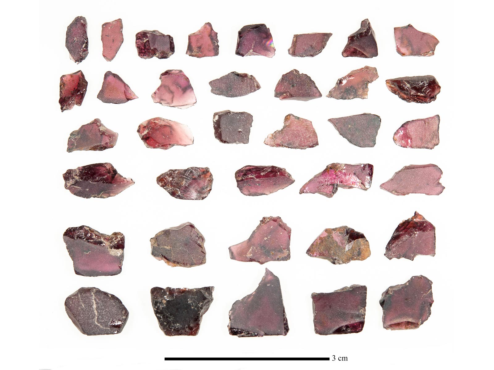
During this last phase of occupation, a major craft industry developed, devoted to the cutting of precious materials. This is seen in the diversity and quantity of objects found in the form of offcuts and rough pieces. Some 3,000 objects were made of 15 or so raw materials, with coral, amethysts and garnets predominating. The latter constitute a significant corpus, illustrating all the stages in the cutting and production of garnet platelets. Thanks to archaeometry, this activity has been identified as a possible link in the operational and commercial chain for the production of cloisonné jewellery, which was in vogue throughout Merovingian Europe until the early 6th century.
The district was abandoned during the 7th century. Before the installation of a cemetery in the 11th century, the district experienced intensive salvage work when the Toulounids built new fortifications in the 9th century, leaving it outside the defensive perimeter. This salvage work resulted in the housing walls disappearing down to Roman levels. They are marked by wide trenches that have cut into the archaeological layers to a depth of several metres. The result is fragmented plans that are difficult to interpret.
Further reading:
M. Bonifay, « Alexandrie. Chantier du théâtre Diana. Note préliminaire sur les sigillées tardives (IVe– VIIe siècles) », Alexandrina 1, Études Alexandrines 1, Le Caire, 1998, p. 141-148.
A.-M. Guimier-Sorbets, « Le pavement du triclinium à la Méduse dans une maison d’époque impériale à Alexandrie », Alexandrina 1, Études Alexandrines 1, Le Caire, 1998, 1998, p. 115-139.
P. Rifa Abou el-Nil, « De l’eau à boire : les maisons du Diana », in I. Hairy (éd.), Du Nil à Alexandrie : Histoires d’eaux, Catalogue d’exposition, Alexandrie, 2011, p. 378-391.
P. Rifa Abou el-Nil, Th. Calligaro, « Un atelier de taille de pierre semi-précieuses à Alexandrie », in M.-T. Dinh-Audouin, D. Olivier, P. Rigny (éd.), Chimie et Alexandrie dans l’Antiquité, Paris, 2020, p. 247-264.
P. Rifa Abou el-Nil, B. Clavel, C. Harlaut, J.W. Hayes, N. Morand, M.-D. Nenna, V. Pichot, A.K. Senol, A. Simony, « Chantier du Théâtre Diana (Alexandrie). Le puits PT446 de la Maison B », in M.-D. Nenna (éd.), Alexandrina 5, Études Alexandrines 50, 2020.

