The Medieval and Ottoman cisterns of Alexandria
From Late Roman times until the beginning of the 20th century, Alexandrians quenched their thirst with water drawn from the city’s countless cisterns. These underground reservoirs were fed every year in summer during the Nile flood by a canal that originally began on the Canopic branch of the Nile, some 30 km to the east of the city. In winter, abundant rainwater was also collected. After the Arab conquest in 642 AD, Alexandria’s master builders began to construct ever larger cisterns. They were built mainly within the city walls, within the ancient and medieval city limits.
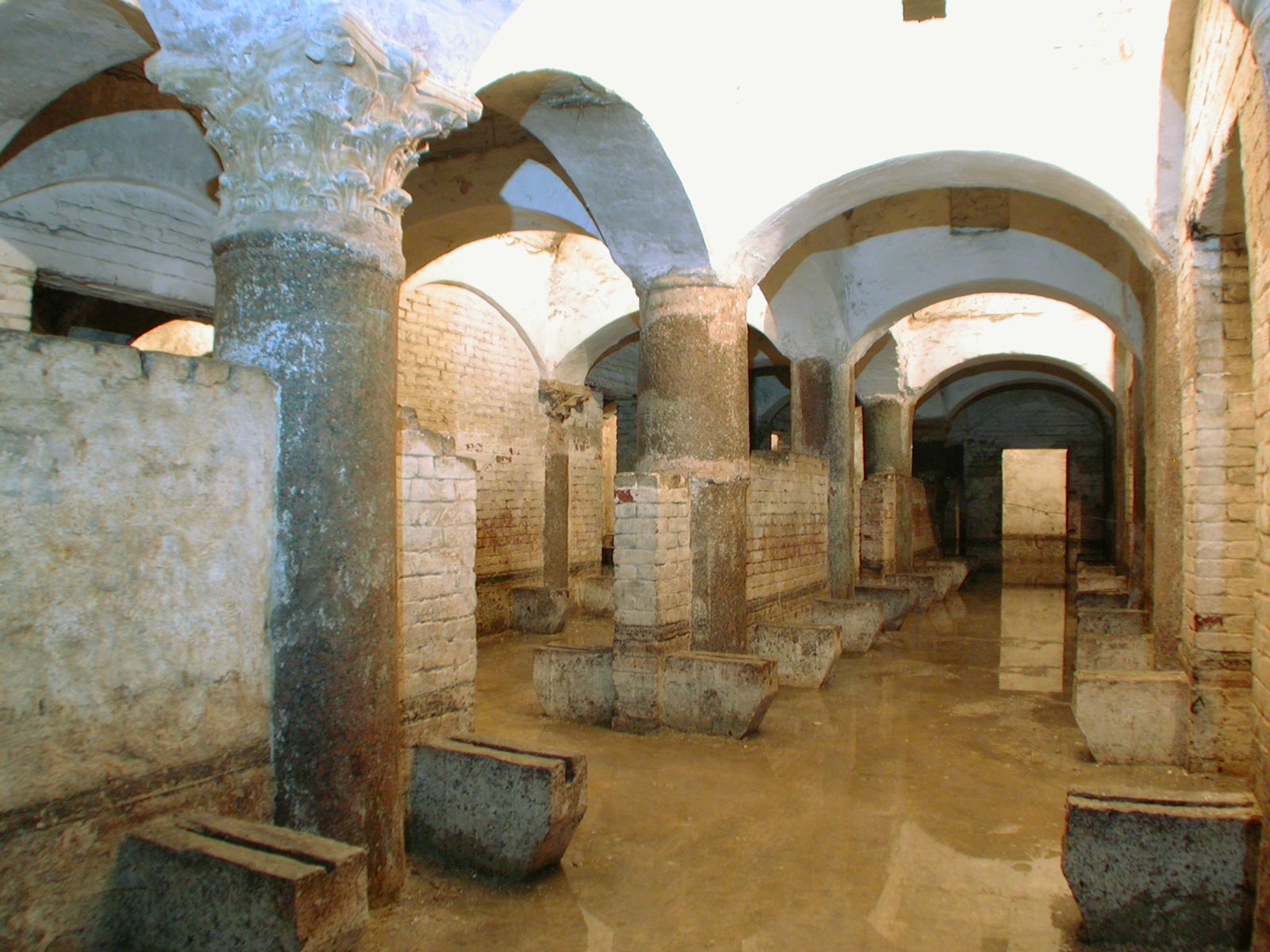
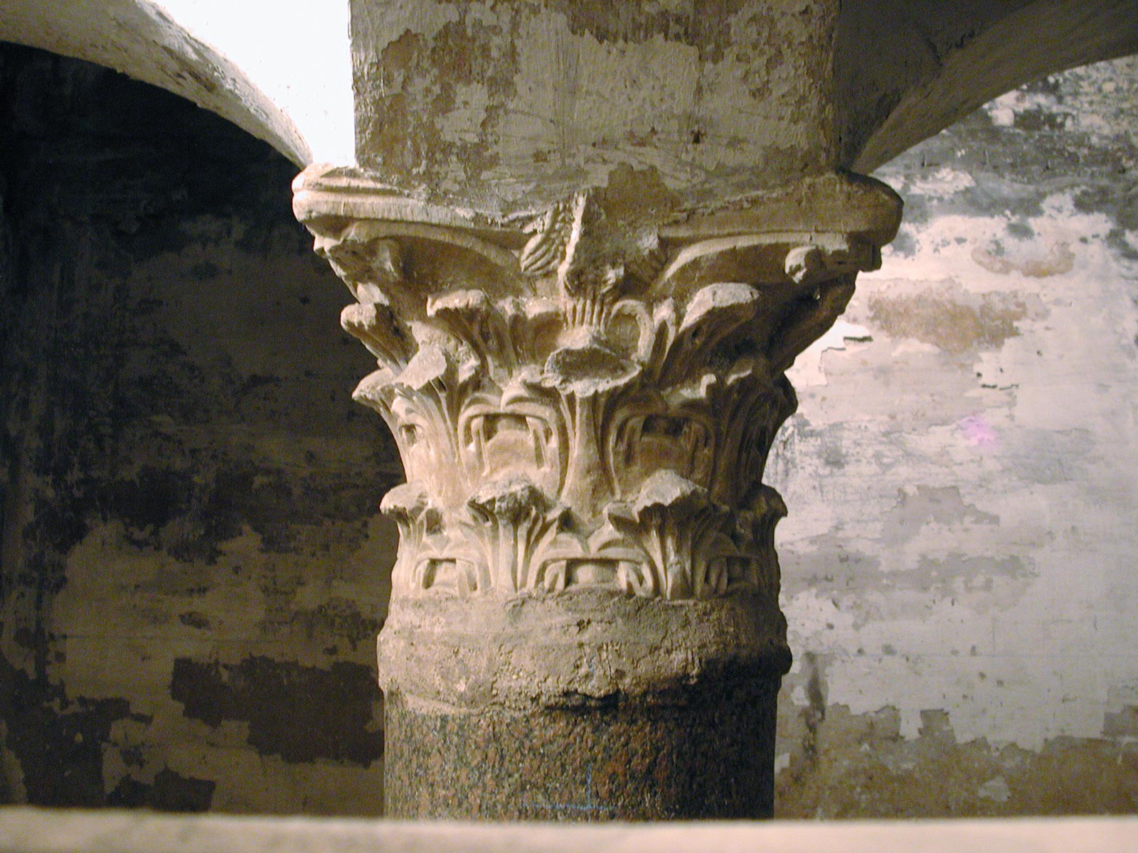
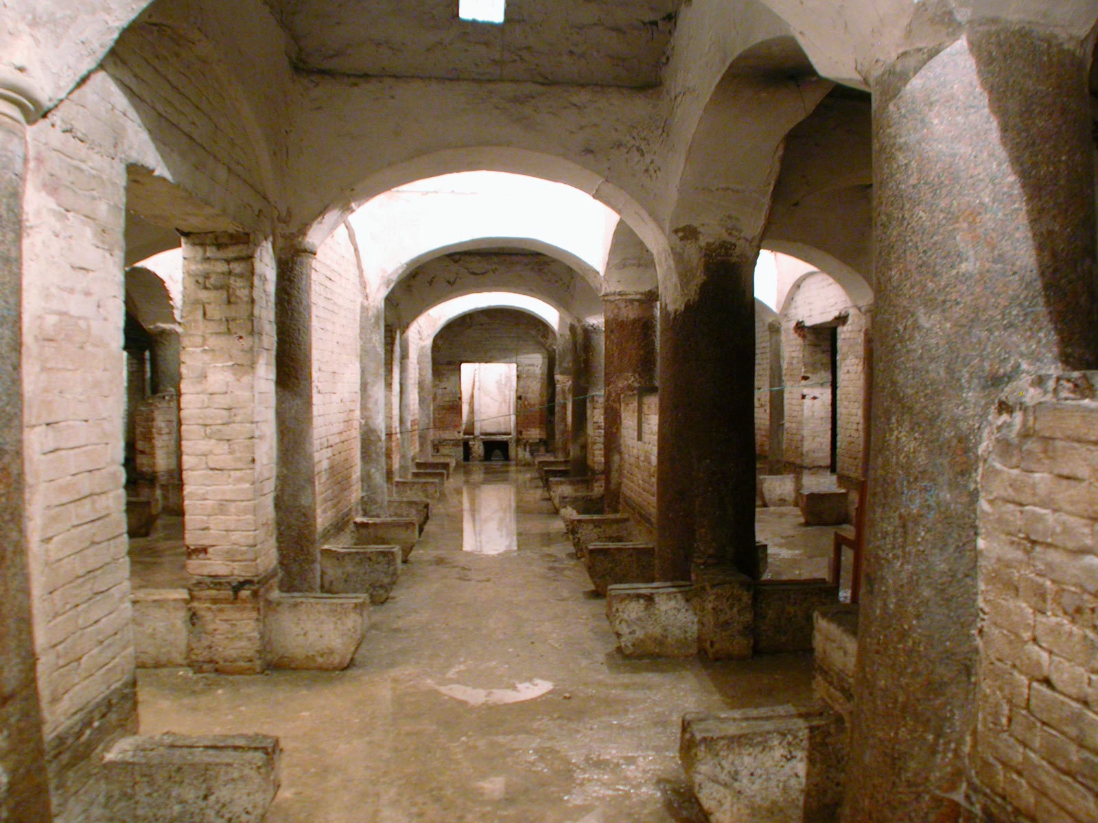
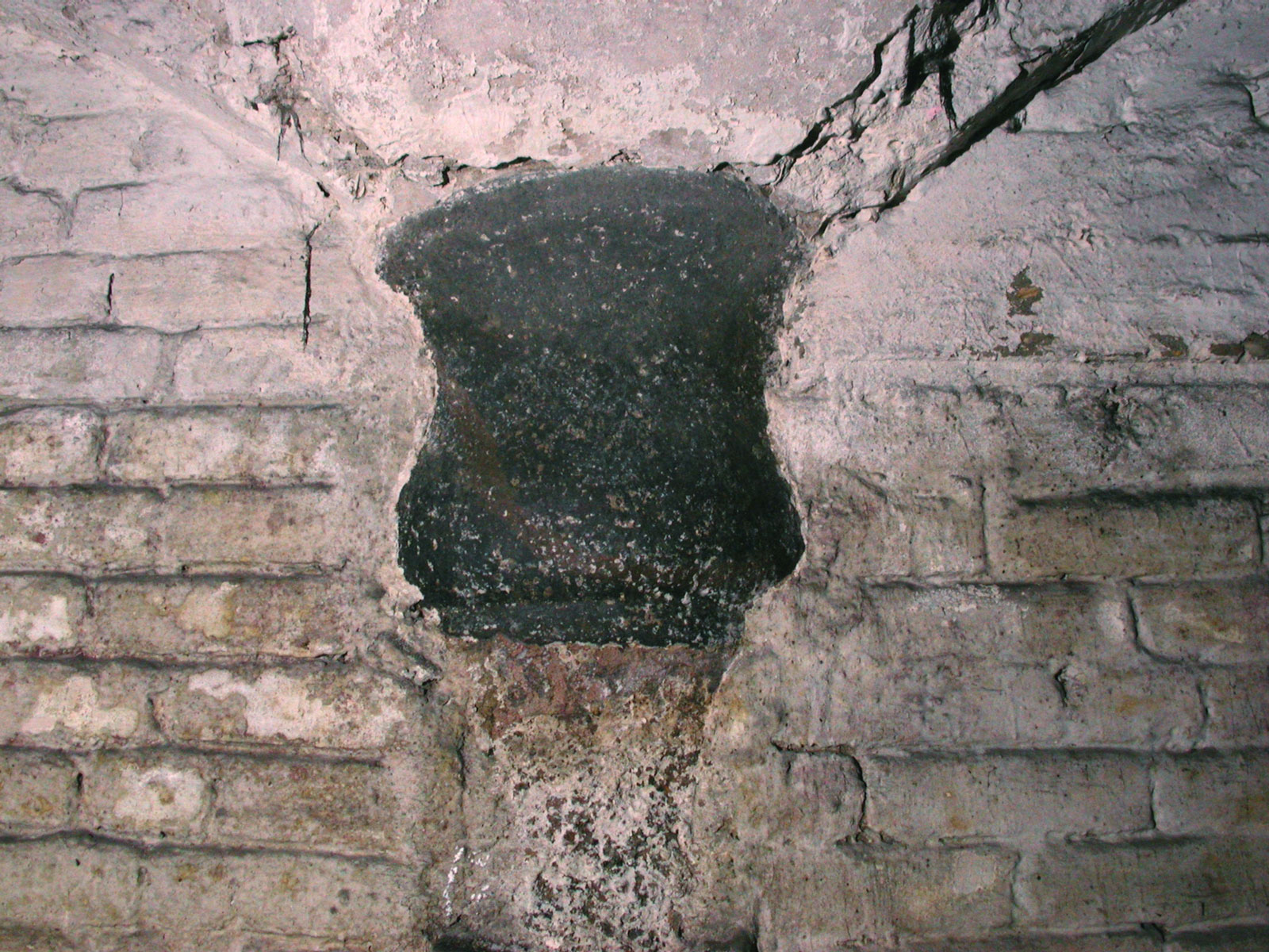
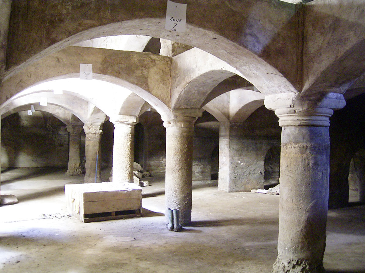
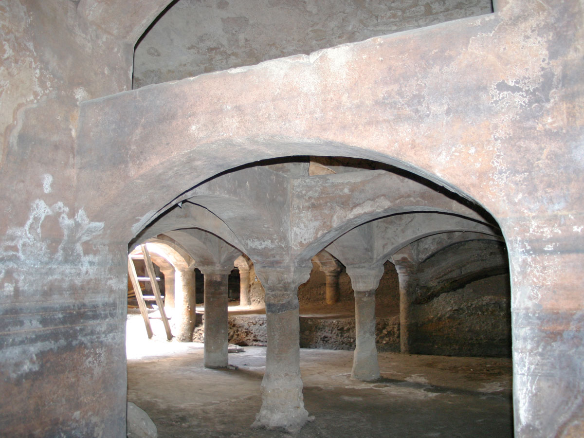
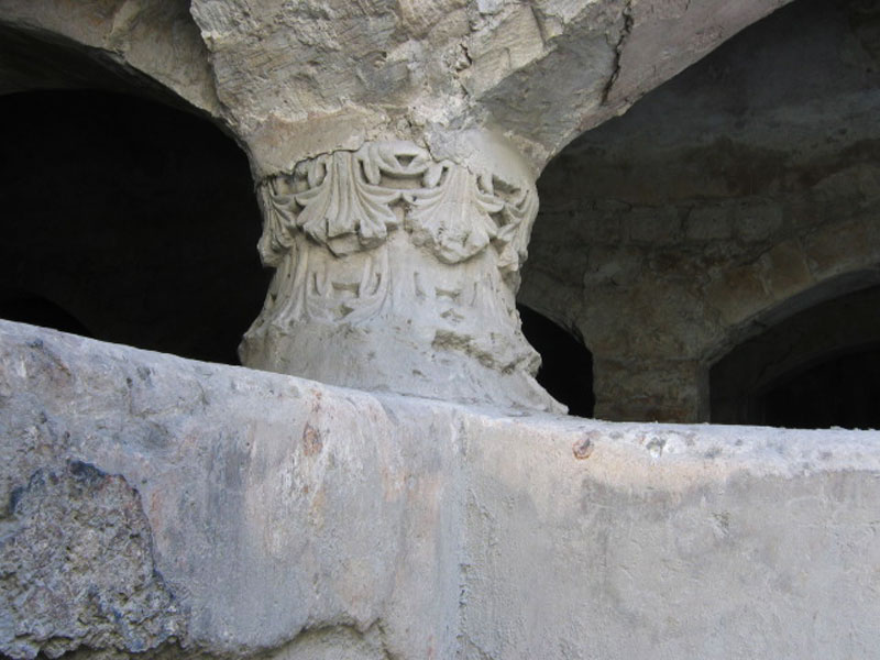
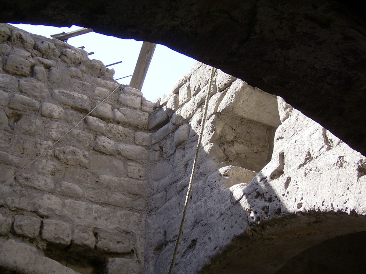
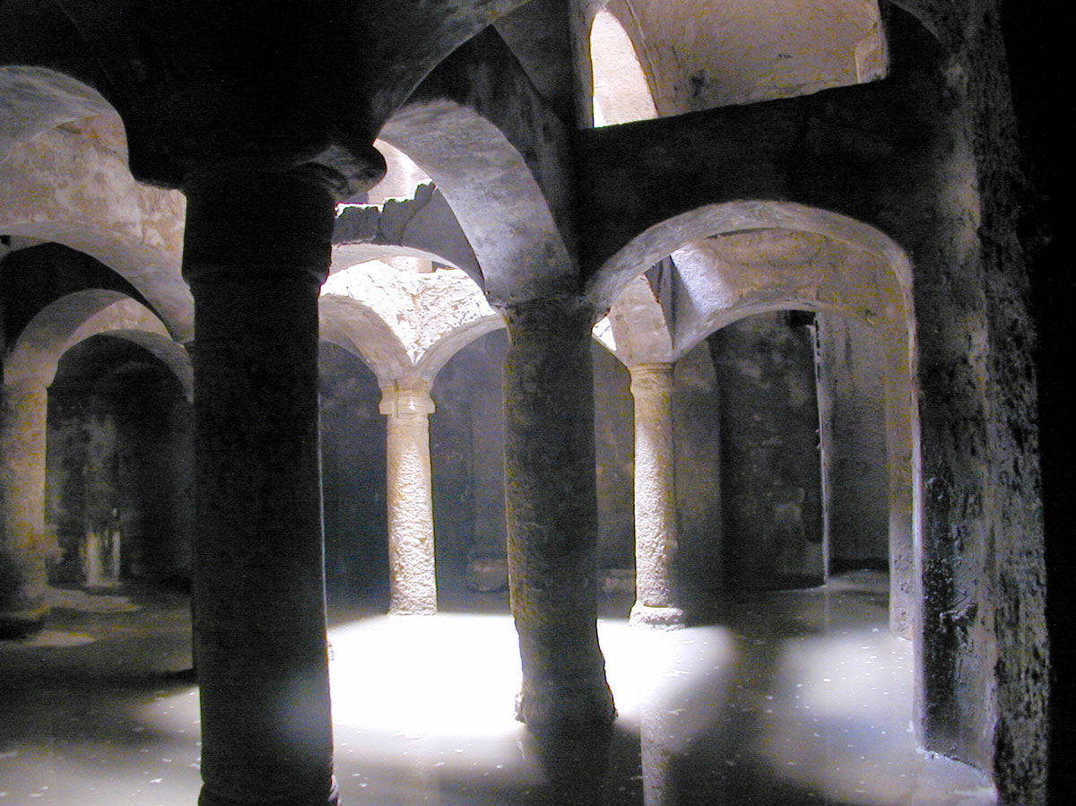
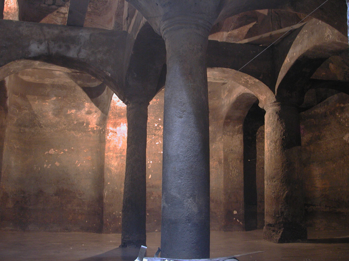
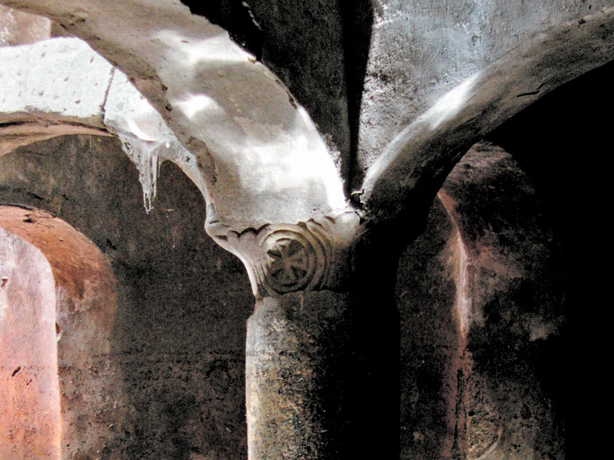
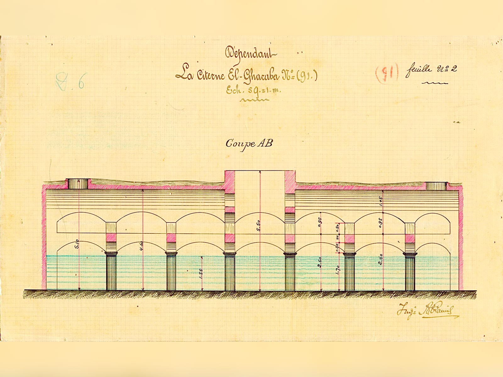
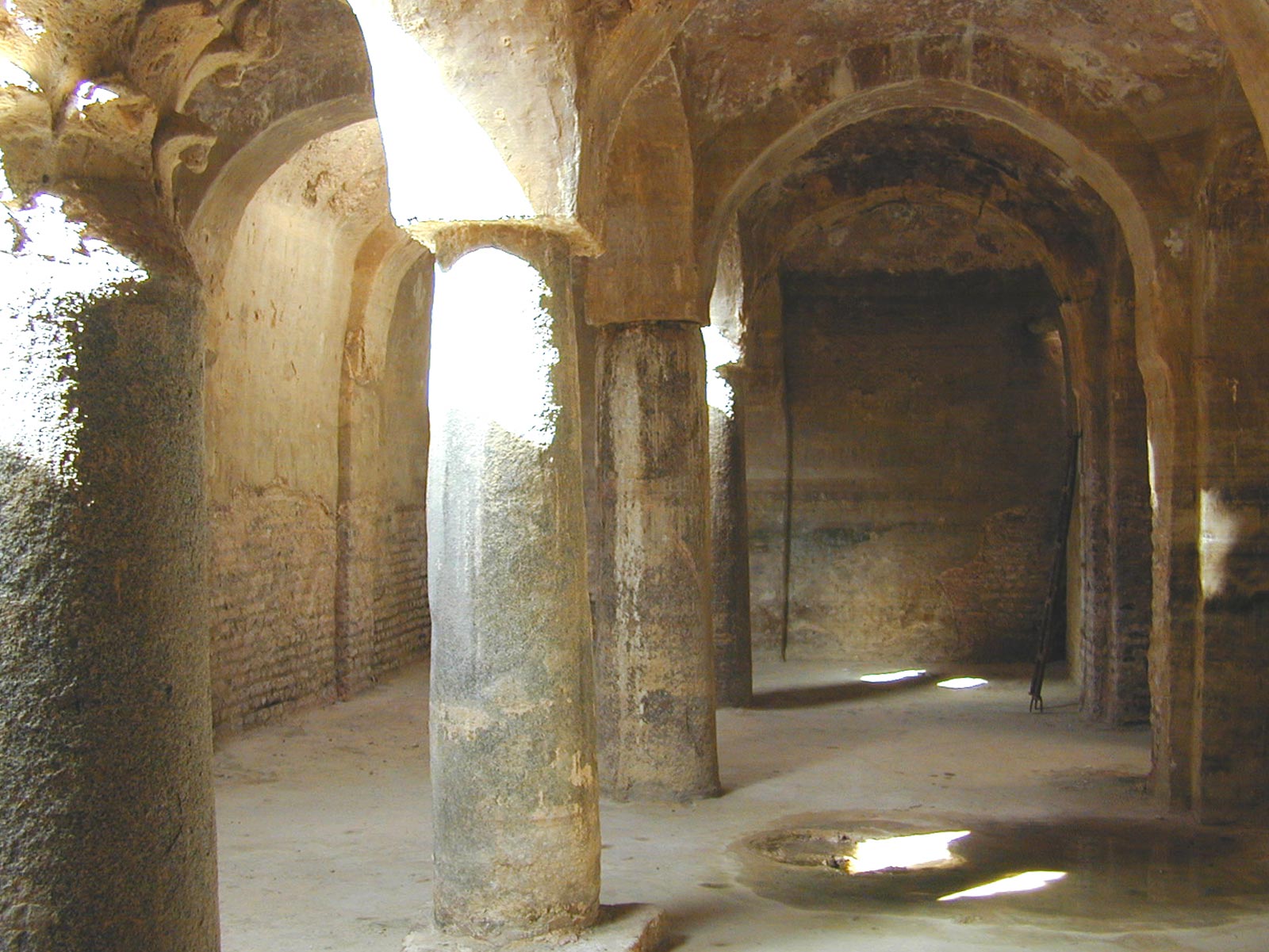
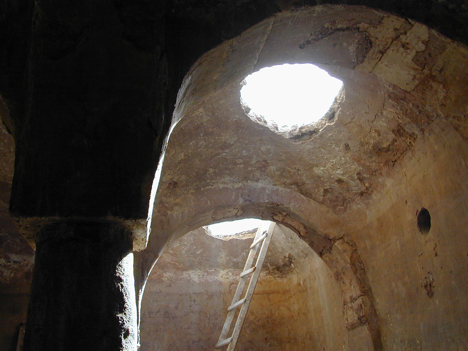
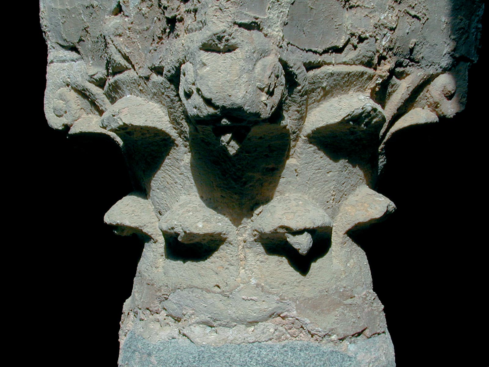
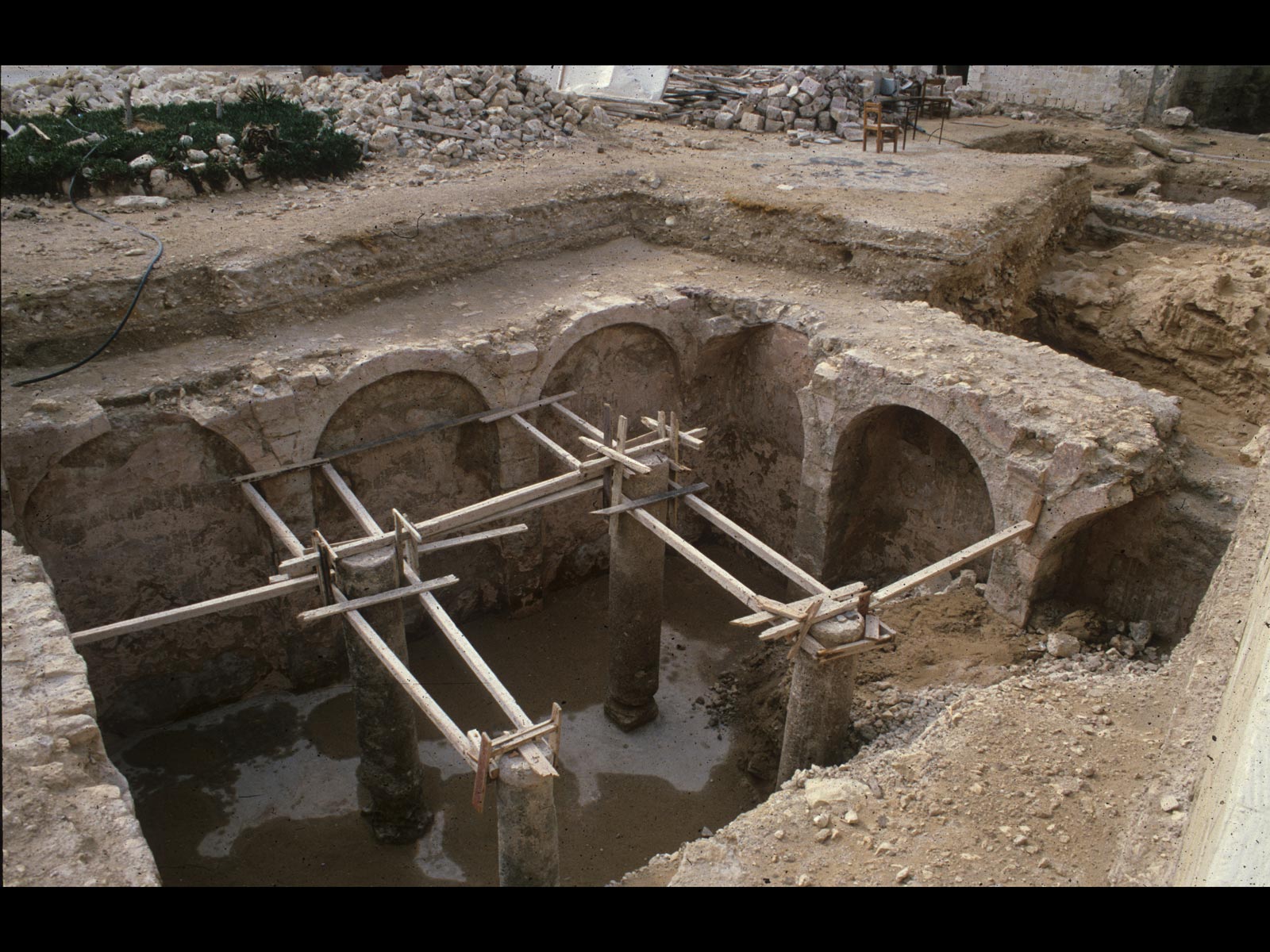
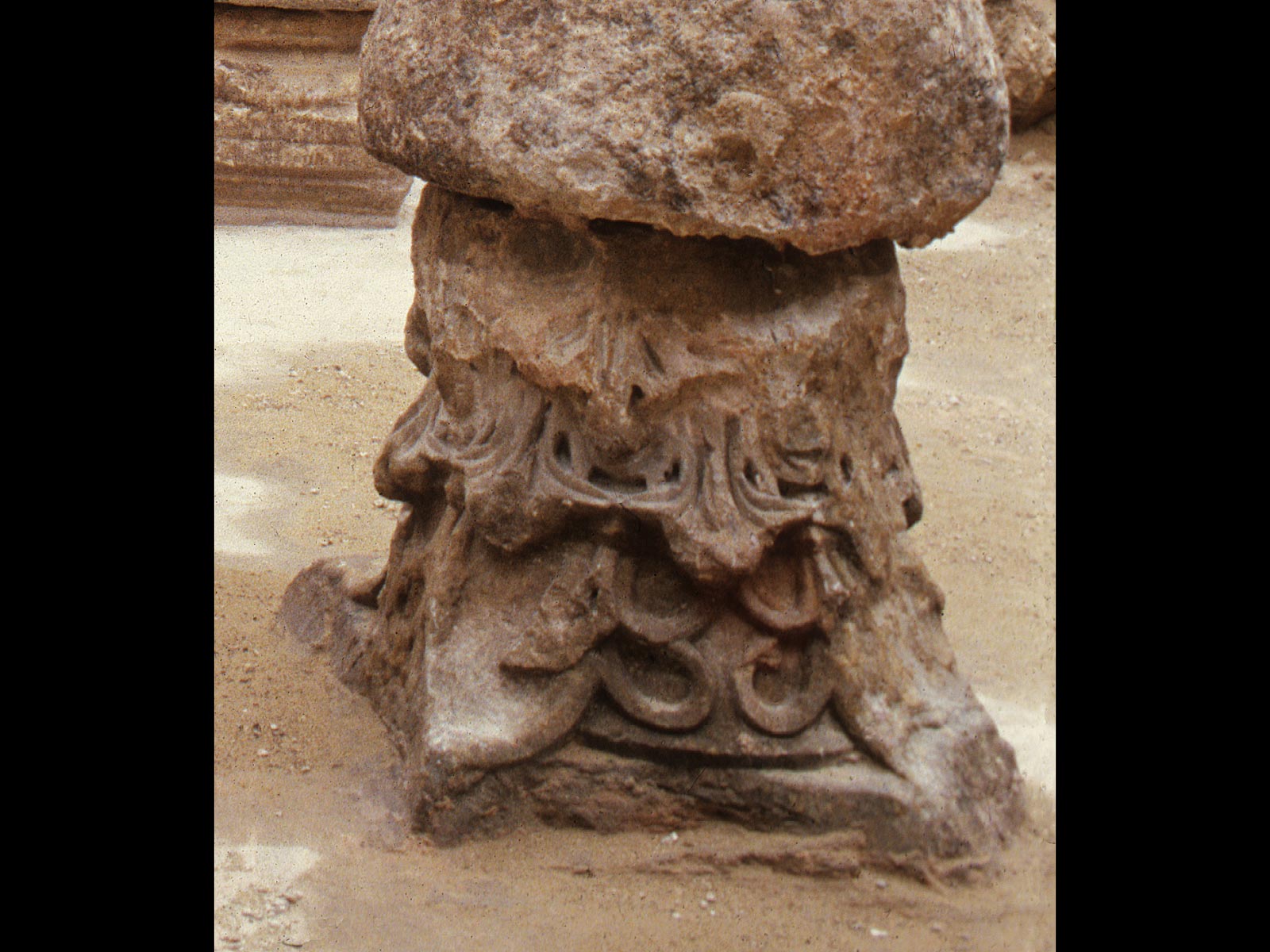
The medieval cisterns of Alexandria are characterised by their enormous cube-shaped volumes with masonry walls, stabilised by an internal frame of a multitude of intersecting columns and arches. The uprights were assembled using architectural elements salvaged from the ruins of the city, such as the shafts of granite columns and marble capitals and bases. This ingenious load-bearing system was both light and strong. It allowed the span of the entire cistern to be subdivided into several parallel bays of lesser width, which were easier to cover with masonry vaults. A hydraulic plaster applied to the walls, floor and ceiling ensured that the reservoir was watertight. A number of shafts were used to draw water and to allow access when the cistern needed to be emptied and cleaned.
We do not know the exact number of medieval cisterns. Thanks to historical documents and various excavations, the CEAlex has been able to list 144 underground reservoirs within and outside the city walls. Today, only around 20 of these cisterns have survived. In the mid-19th century, however, the astronomer Mahmoud Bey el-Falaki counted no fewer than 700 beneath the surface of the city.
The main reason for the almost total disappearance of this ancient water system was the frequency of epidemics due to the insanitary nature of the water from the cisterns. At the end of the 19th century, the foundation of a new water company led to the installation of a modern water supply network. In 1911, the Municipality of Alexandria formally banned the drawing of water from cisterns and encouraged residents to abandon and fill them. Most of the cisterns were subsequently destroyed.
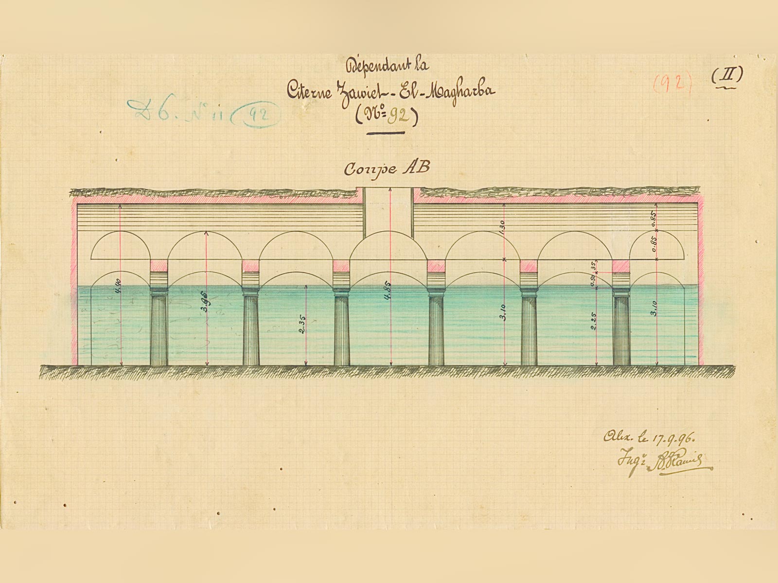
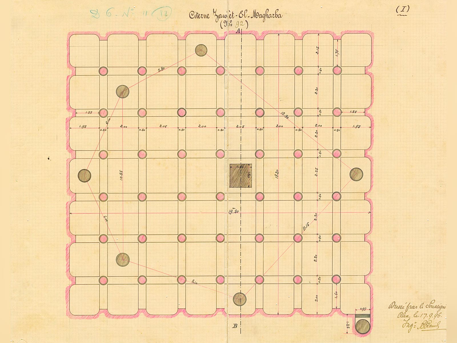
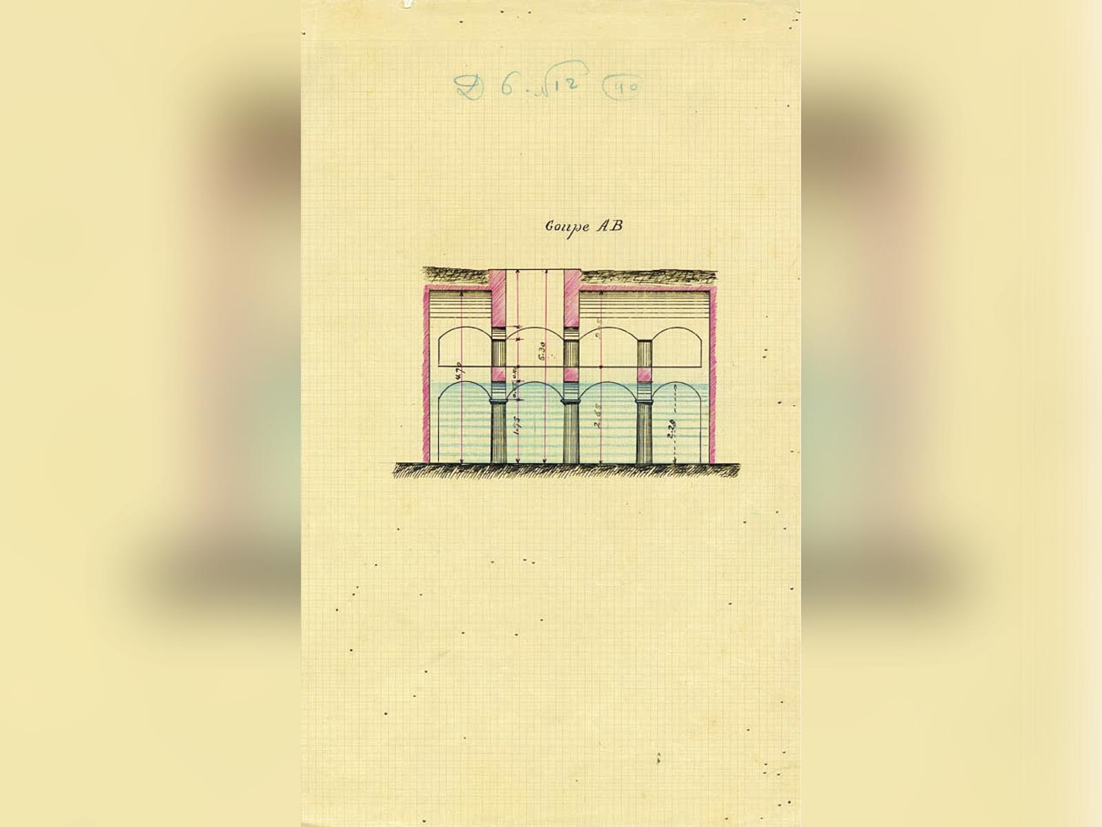
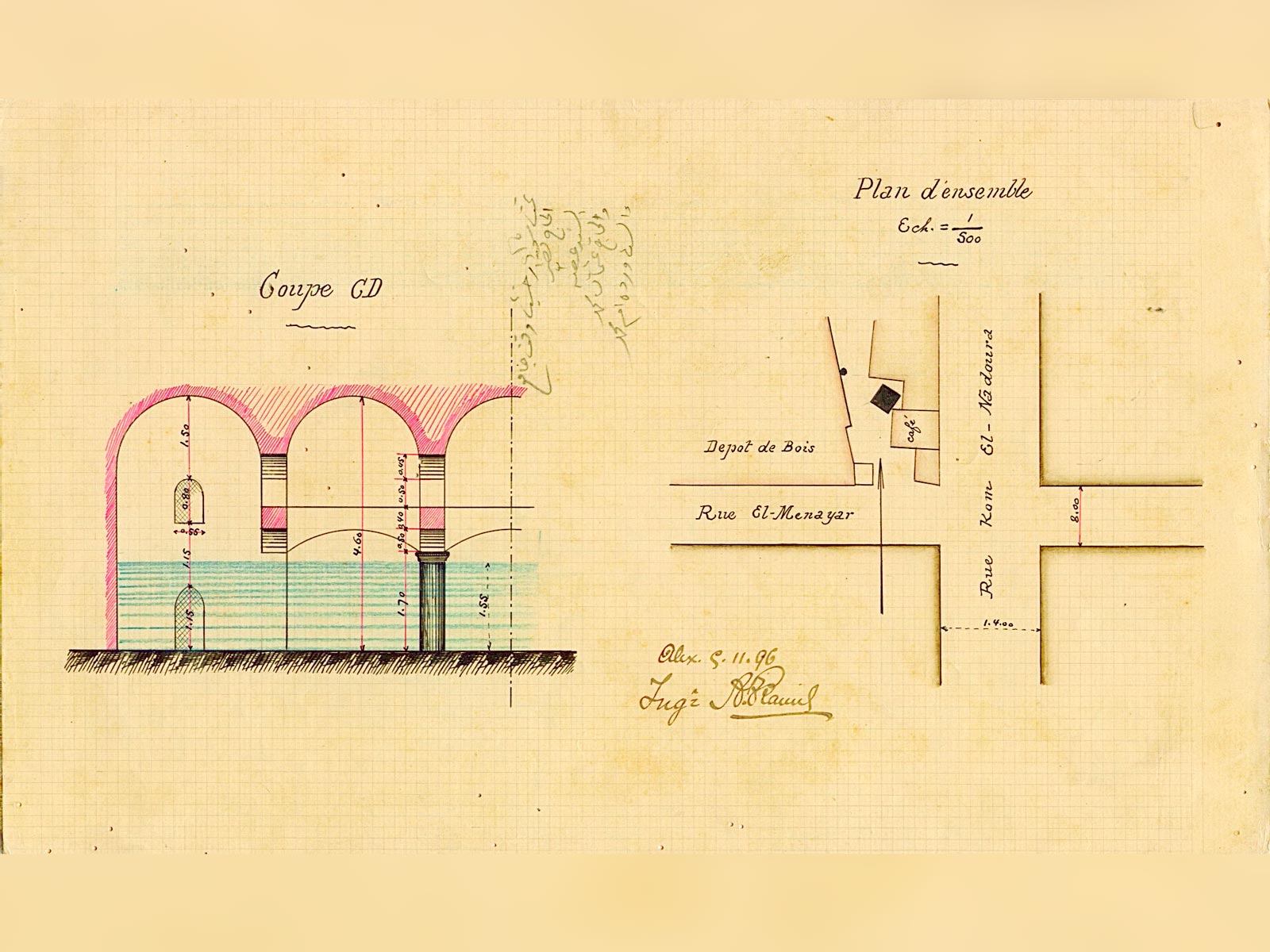
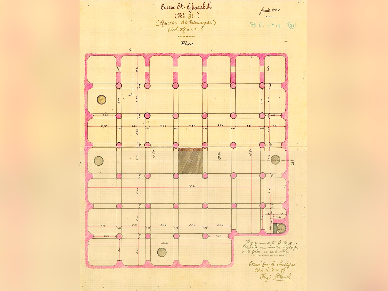
Nevertheless, having realised the architectural value of this particular built heritage, the Municipality commissioned an engineer, A. Kamil, to carry out a comprehensive inventory of Alexandria’s cisterns. Between 1896 and 1899, he mapped 136 cisterns and drew up detailed plans and cross sections. Three cisterns were subsequently included in the list of Arab monuments to be preserved. This precious file of architectural drawings is kept in the archives of the Graeco-Roman Museum in Alexandria.
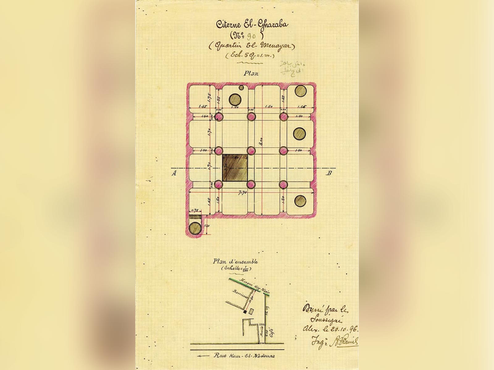
Since its foundation, the CEAlex has been interested in the cisterns of Alexandria, setting up a geographical information system to locate, register and document them. The CEAlex has also carried out in-depth studies of the El-Nabih cistern, which is a multi-storey reservoir, the Ibn Battuta cistern, which was transformed into an air raid shelter during the Second World War, the Gharaba cisterns, which were used as a water reservoir for a café at the end of the 19th century, and finally the Qaitbay Fort cisterns, built for the garrison that guarded the Alexandria’s Eastern Harbour.
El-Nabih cistern
El-Nabih cistern in what is now Shallalat Gardens was registered in 1898 and by 1890 the Municipality had fitted an external staircase to allow tourists to visit the monument though they could only catch a glimpse of the interior through a window cut into the eastern wall.
The great cubic interior (11.50 m by 13 m) with an operating capacity of 1200 m³ reaches down some 11 m below current ground level. The three levels of 16 columns connected by 40 arches create dizzying views which have earned the cistern the nickname of “the underground cathedral”.
Beginning in 1996 the CEAlex has conducted several surveys of this cistern followed up by archaeological excavations of the surface of the site between 2006 and 2012.
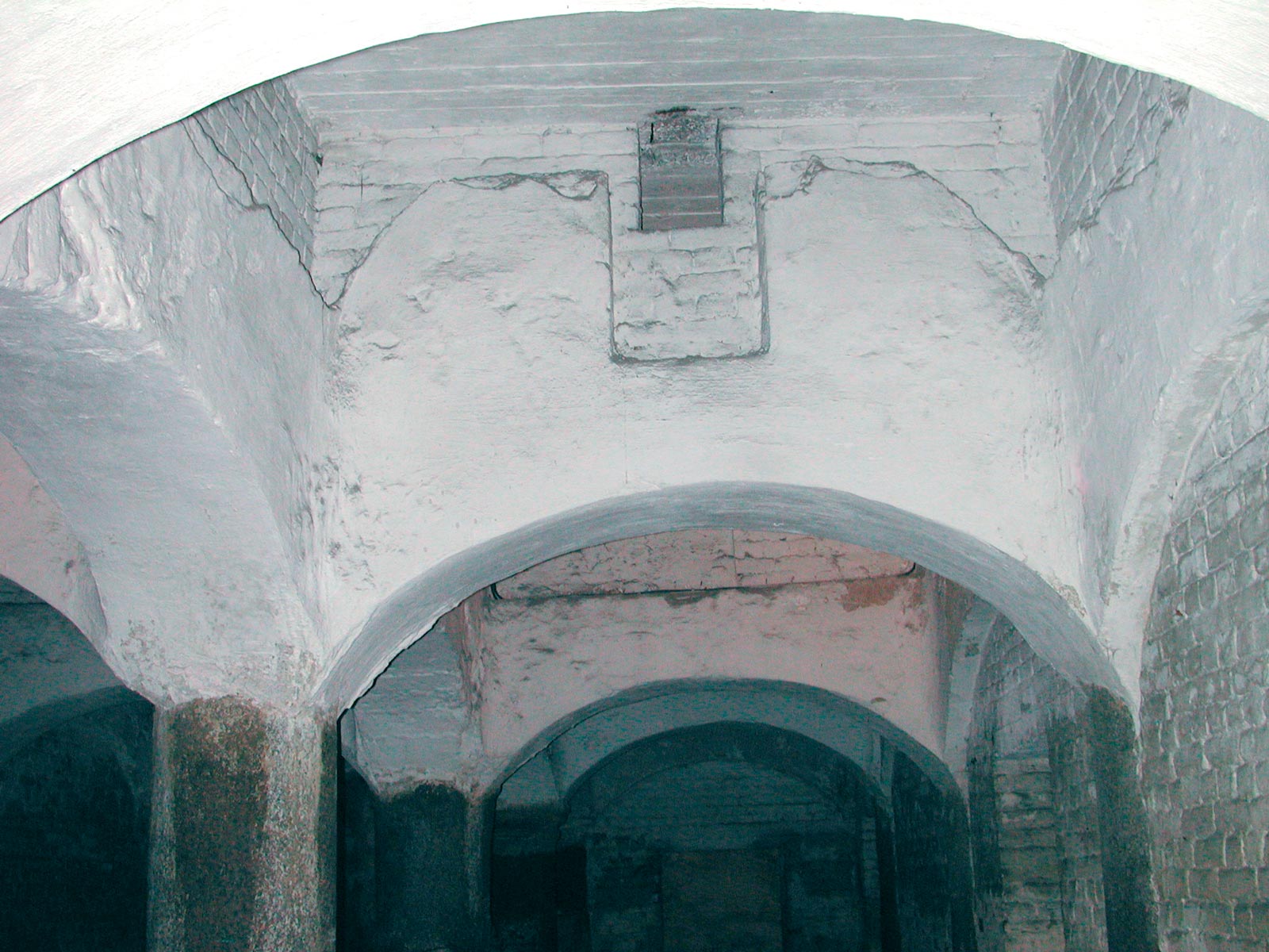
The employment of several levels in conjunction with an examination of the material revealed during excavations have dated construction to between the 11th and 13th century, multi-storey cisterns having been introduced by the Fatimids. Analysis of the structure revealed a significant restoration phase which most probably occurred between the 16th and 19th century. The southern half of the roofing, originally composed of groined vaults was then replaced by barrel vaults.
The builders of this cistern chose to locate it within the shelter of the medieval defensive wall, near to the Rosetta Gate which was then the entrance point for caravans coming from the Delta and Cairo. The close proximity of the wall as well as one of the great towers of that fortification would suggest that the cistern was used by the military. In the Middle Ages the cistern was also located not far from the Christian quarter which held inns for foreign merchants and the great maritime trade market.
The CEAlex has drawn up an architectural development project aimed at the restoration and presentation of this cistern, along with the creation of a museum of water supply. This document has been presented to the Egyptian authorities.
Ibn Battuta cistern
The Ibn Battuta cistern is located to the south of Kom el-Nadoura hill, which in the Middle Ages featured a watchtower looking out over the two harbours.
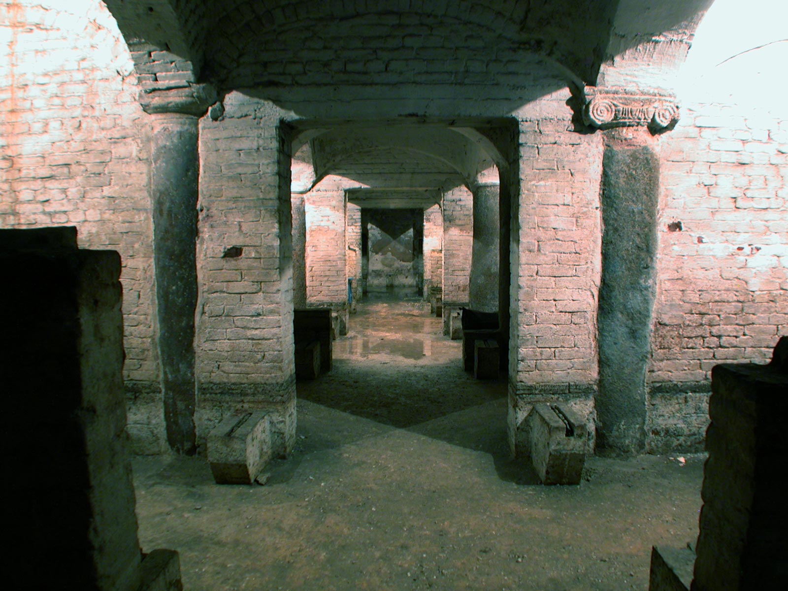
This cistern has approximately the same capacity as El-Nabih, but was built on one and a half levels and so its ground plan is much larger (19.20 m by 19.60 m) and its depth is only 5 m. Ninety-seven arches are supported by 42 columns holding up a ceiling of reinforced concrete that was installed during the Second World War when the cistern was turned into an air raid shelter. Originally the roof was composed of eight parallel barrels vaults, which were recorded by the engineer Kamil in 1896. During redevelopment work in 1940, the inside was subdivided into four equal sections by the installation of masonry partition walls along the length of every second arcade. A fresh air system, nine squatter toilets and wooden benches for 350 people provided basic facilities.
The cistern was opened to tourists in 1984 but it is currently inaccessible because of the constantly flooded state of the interior. In 2003 architects from the CEAlex undertook a comprehensive survey and drew up an inventory of all the re-used architectural elements, including several Early Christian capitals. An Islamic capital of the bulbous Sassanid type, made at the end of the 9th century, set the cistern’s construction date to between the 10th and 15th century.
It is interesting to note that the orientation of this cistern differs significantly from the grid plan street layout of the present-day district.
The two Gharaba cisterns
These two cisterns, located 250 m south of the Ibn Battuta cistern, have been surveyed and excavated by the CEAlex. The larger of the two is comparable to the Ibn Battuta in dimensions (18.80 m by 19.80 m), volume and morphology. Here, there are 74 arches sitting upon 28 columns and six load bearing lateral walls supporting a ceiling of seven parallel barrel vault, with a large central well shaft. A deep recess at the north corner marks the site of a saqieh, that is, a wheel and jar mechanism that was used to fill the cistern.
The other cistern, situated slightly to the north, is barely quarter of the surface area (7.50 m by 7.90 m) and has only nine columns on one level and a half, but the reservoir is just as deep at 5.30 m.
Between 2000 and 2005, the CEAlex carried out excavations on the surface of the site and inside the large cistern. The finds (a water heater, bottles of imported drinks, French crockery and Ottoman pipes) showed that the cistern was used as a water reservoir for a European-style café towards the end of the 19th century. The discovery of an American Remington Rolling Block rifle and a French bayonet are reminders of the equipment used by the Egyptian army at the end of the 19th century.
When the café was demolished at the beginning of the 20th century, the large cistern was also abandoned and used as a dump for debris from the café. Subsequently, the reservoir was used as a dumping ground for local residents.
In the Middle Ages, the Ibn Battuta and Gharaba cisterns were located in the city’s administrative, religious and military quarter, where foreigners were forbidden access. This was where the main Friday Mosque, the governor’s palace, the citadel and an armoury were located. A large gate in the defensive wall opened onto the Western Harbour, the dock reserved for Muslims. The cisterns in this area were probably used, among other things, to resupply ships. They were fed by an underground aqueduct.
Geo-referencing has revealed that the three cisterns in this quarter lie parallel to the present-day Fouad Street, which follows the line of the main thoroughfare of the Middle Ages. Other sections of today’s alleyways, as well as the site of the Thousand Columns Mosque, also follow this ancient pattern.
The cisterns of Qaitbay Fort
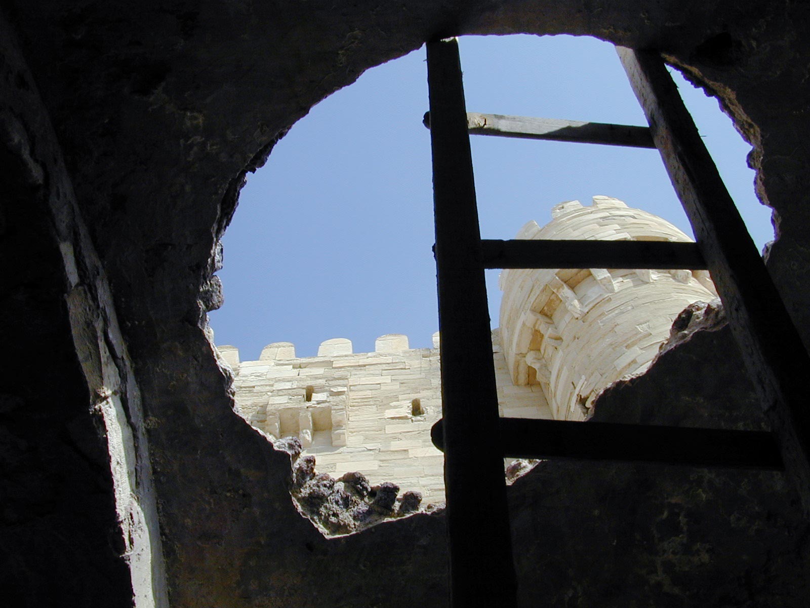
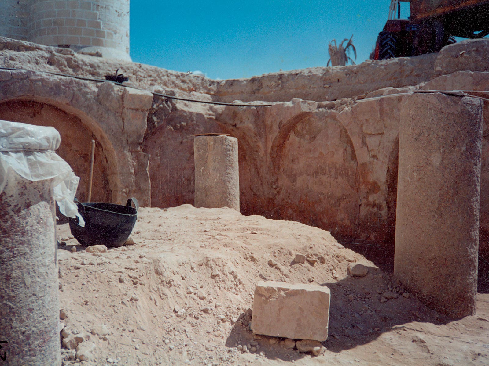
The CEAlex conducted archaeological excavations between 2000 and 2003 on two other hypostyle cisterns outside the Medieval defensive walls. Qaitbay Fort was built at the end of the 15th-beginning of the 16th century at the entrance to the Eastern Harbour, and was equipped with underground reservoirs used to supply the garrison with water for drinking, ablutions and daily tasks.
With an operating capacity of 270 m³ for the smaller cistern and around 450 m³ for the larger, their volume is smaller than that of the town’s cisterns. The cistern whose access shaft opens into the fort’s keep is built on a rectangular plan (5.10 m by 13.30 m) and has only one central arcade of four columns on one level. The roof features ten small fired-brick domes.
The neighbouring cistern is wider (8.70 m) and has two arcades that also supported fired-brick domes, fragments of which were found on the abandoned layers of this structure. Five columns were uncovered during excavations; the other vertical load-bearing elements are hidden beneath recent buildings. The cistern was abandoned and filled in during the 18th century when a new artillery platform was built on the site. Its original length therefore remains unknown.
Further reading:
D. Dixneuf, avec une introduction de L. Borel, La céramique des fouilles autour de la citerne el-Nabih (Alexandrie), Études Alexandrines 52, 2020, sous presse.
I. Hairy (éd.), Du Nil à Alexandrie. Histoires d’eaux, catalogue d’exposition, Alexandrie, 2011.
I. Hairy, Éléments pour l’étude du système hydraulique d’Alexandrie du ive siècle avant J.-C. au xixe siècle après J.-C., DEA, Université Lyon II, 2002.
I. Hairy, « Alexandrie médiévale. La question d’eau », in Chr. Décobert, J.-Y. Empereur (éd.), Alexandrie médiévale 3, ÉtAlex 16, Institut français d’archéologie orientale, Le Caire, 2008, p. 263-278.
I. Hairy, Les coulisses de l’eau à Alexandrie. Les petits guides d’Alexandrie, Alexandrie, 2008, édition en arabe et français.
I. Hairy, « L’eau alexandrine : des hyponomes aux citernes », in I. Hairy (éd.), Du Nil à Alexandrie. Histoires d’eaux, catalogue d’exposition, Alexandrie, 2011, p. 212-239.
I. Hairy, O. Sennoune, « Le canal d’Alexandrie : la course au Nil », in I. Hairy (éd.), Du Nil à Alexandrie. Histoires d’eaux, catalogue d’exposition, Alexandrie, 2011, p. 140-161.
Y. Guyard, G. Hairy, I. Hairy, « Chantier el-Gharaba : des citernes au débit de boisson », in I. Hairy (éd.), Du Nil à Alexandrie. Histoires d’eaux, catalogue d’exposition, Alexandrie, 2011, p. 344-363.
Chr. March, L. Borel, « Citerne el-Nabih, un dispositif remarquable de l’hydraulique alexandrine », in I. Hairy (éd.), Du Nil à Alexandrie. Histoires d’eaux, catalogue d’exposition, Alexandrie, 2011, p. 424-447.
L. Borel, Chr. March, « Le projet el-Nabih : Conservation d’un symbole du patrimoine hydraulique alexandrin », in I. Hairy (éd.), Du Nil à Alexandrie. Histoires d’eaux, catalogue d’exposition, Alexandrie, 2011, p. 448-461.
I. Hairy, C. Shaalan, « Qualité de l’eau et maladies hydriques », in I. Hairy (éd.), Du Nil à Alexandrie. Histoires d’eaux, catalogue d’exposition, Alexandrie, 2011, p. 478-493.
K. Machinek, « L’eau dans les fortifications à Alexandrie », in I. Hairy (éd.), Du Nil à Alexandrie. Histoires d’eaux, catalogue d’exposition, Alexandrie, 2011, p. 590-609.
K. Machinek, « La citerne Ibn Battouta dans le quartier de Kôm el-Nadoura », in I. Hairy (éd.), Du Nil à Alexandrie. Histoires d’eaux, catalogue d’exposition, Alexandrie, 2011, p. 462 475.
K. Machinek, Das Fort Qaitbay in Alexandria – Baugeschichte und Architektur einer mamlukischen Hafenfestung im mittelalterlichen Stadtbefestigungssystem von Alexandria ; thèse de doctorat, soutenue à la Faculté d’Architecture de l’Université de Karlsruhe (KIT) en 2014.
K. Machinek, « Hygiene in islamischen Festungsbauten », in O. Wagener (éd.), Aborte im Mittelalter und der Frühen Neuzeit – Bauforschung, Archäologie, Kulturgeschichte, Studien zur internationalen Architektur- und Kunstgeschichte 117, Petersberg, 2014, p. 292-301.
K. Machinek, « Deux citernes hypostyles dans le fort Qaitbay à Alexandrie », in M.-D. Nenna (éd.), Alexandrina 5, Études Alexandrines 50, 2020 (sous presse) .

